Latitude: 52.1066 / 52°6'23"N
Longitude: -2.0729 / 2°4'22"W
OS Eastings: 395104
OS Northings: 245364
OS Grid: SO951453
Mapcode National: GBR 2JM.YJ5
Mapcode Global: VHB0R.190Y
Plus Code: 9C4V4W4G+JR
Entry Name: The Toll House
Listing Date: 5 December 1995
Grade: II
Source: Historic England
Source ID: 1386983
English Heritage Legacy ID: 474399
ID on this website: 101386983
Location: Pershore, Wychavon, Worcestershire, WR10
County: Worcestershire
District: Wychavon
Civil Parish: Pershore
Built-Up Area: Pershore
Traditional County: Worcestershire
Lieutenancy Area (Ceremonial County): Worcestershire
Church of England Parish: Pershore
Church of England Diocese: Worcester
Tagged with: House
PERSHORE
SO9545 BRIDGE STREET 648-1/5/63 (West side) 05/12/95 No.80 The Toll House
GV II
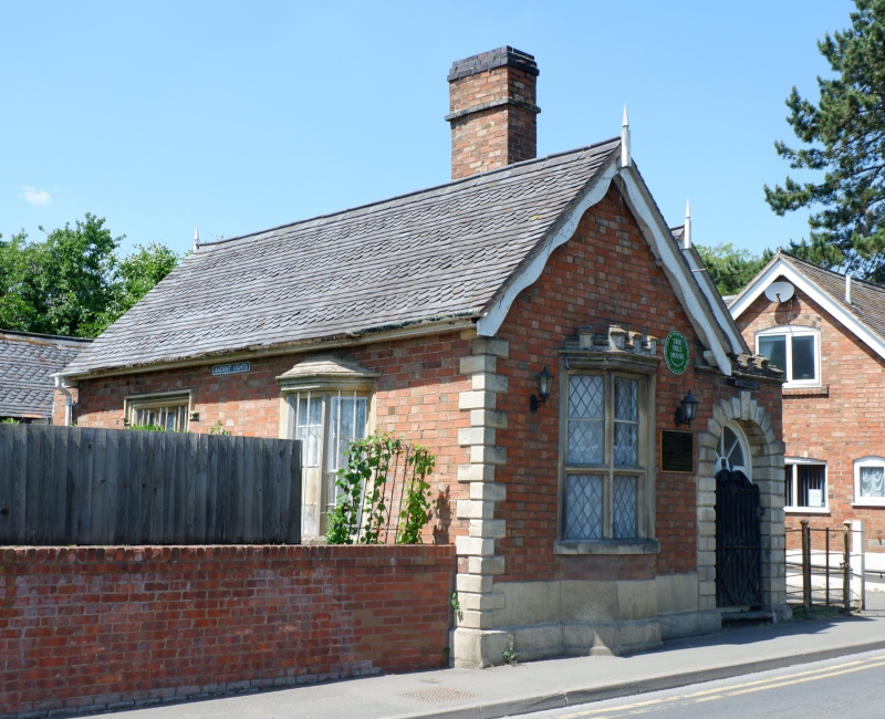
Toll house now private house. c1860. Red, yellow and blue brick in Flemish garden wall bond with stone dressings. Tile roof, with bands of fish-scale tiles to left range; 2 staggered cross gables with renewed decorative bargeboards and finials; and tall brick central ridge stack. EXTERIOR: single storey. To left, 6-pane canted bay-window with moulded stone mullions, transoms, sill and embattled parapet. To right, 2-light window with moulded stone surround, mullions, sill and hoodmould; one metal casement; iron window bars. Central semi-integral embattled porch with similar smaller side-window and round-arched doorway with rusticated, keyed, surround; fanlight with radial glazing bars; panelled door with metal outer door; and 2 stone steps. Inner former stable-type door. Rusticated stone quoins, stone plinth and blue brick plinth course. Left elevation has further similar mullioned windows with metal bars, and wing with blue and yellow brick pattern in gable. INTERIOR: has an elaborately carved fireplace surround. HISTORICAL NOTE: built for the Trustees of the Pershore Division of the Evesham First District of Turnpike Roads on land conveyed by the Dean and Chapter of Westminster Abbey.
Listing NGR: SO9510445364
External links are from the relevant listing authority and, where applicable, Wikidata. Wikidata IDs may be related buildings as well as this specific building. If you want to add or update a link, you will need to do so by editing the Wikidata entry.


Other nearby listed buildings