Approximate Location Map
Large Map »
Latitude: 50.7947 / 50°47'40"N
Longitude: -1.0989 / 1°5'55"W
OS Eastings: 463608
OS Northings: 99846
OS Grid: SZ636998
Mapcode National: GBR VPS.VB
Mapcode Global: FRA 86LZ.V06
Plus Code: 9C2WQWV2+VF
Entry Name: Hms Temeraire, Old Gymnasium, Now Squash Courts
Listing Date: 25 September 1972
Last Amended: 18 March 1999
Grade: II
Source: Historic England
Source ID: 1386908
English Heritage Legacy ID: 474321
ID on this website: 101386908
Location: HMS Temeraire, Portsmouth, Hampshire, PO1
County: City of Portsmouth
Electoral Ward/Division: St Thomas
Parish: Non Civil Parish
Built-Up Area: Portsmouth
Traditional County: Hampshire
Lieutenancy Area (Ceremonial County): Hampshire
Church of England Parish: St Thomas of Canterbury, Portsmouth
Church of England Diocese: Portsmouth
Tagged with: Architectural structure
PORTSMOUTH
SZ6399 BURNABY ROAD
774-1/12/3 (West side)
25/09/72 HMS Temeraire, Old Gymnasium, now
squash courts
(Formerly Listed as:
BURNABY ROAD
The Gymnasium)
II
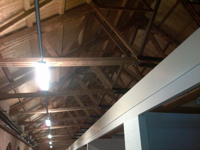
Army physical training and drill hall, now naval squash
courts. c1860-65, fire-damaged 1970s; restored and converted
1984-6. Yellow brick in Flemish bond. Replacement slate roof.
EXTERIOR: one storey, with gallery across south end. 1:8 x 3
bays. Chamfered plinth. Rusticated pilaster strips at angles,
supporting open pediments on gable elevations (north and
south). Round-arched recesses contain round-arched windows
with metal glazing bars (1980s, reproducing previous windows);
stone sills; double impost band. Stepped dentilled eaves.
Ashlar kneelers to brick gable coping. West and east
elevations have windows arranged 2:4:2. North elevation has 3
blind window openings, a door inserted in left one, and 3
pointed-headed niches above. South elevation has lower,
gabled, projection with flat-roofed side wings. Round-arched
recess contains segmental-arched doorway with double door and
overlight; round-arched windows to either side and above;
stepped plat band; similar windows to side-wings which have
blocking courses; ridge stack.
INTERIOR: at south end, a 3-bay round-arched arcade at gallery
level with 2 iron columns and stone imposts at ends; blocked
roundel to gable. Roof structure all of 1980s date. The
building was erected on the site of former town defences when
those were discarded; it appears on the first OS Map of
1865/70.
Listing NGR: SZ6360899846
External links are from the relevant listing authority and, where applicable, Wikidata. Wikidata IDs may be related buildings as well as this specific building. If you want to add or update a link, you will need to do so by editing the Wikidata entry.


Other nearby listed buildings
