Latitude: 52.1078 / 52°6'28"N
Longitude: -2.0734 / 2°4'24"W
OS Eastings: 395067
OS Northings: 245498
OS Grid: SO950454
Mapcode National: GBR 2JM.YCW
Mapcode Global: VHB0R.09Q0
Plus Code: 9C4V4W5G+4J
Entry Name: The Ley School
Listing Date: 11 February 1965
Grade: II
Source: Historic England
Source ID: 1386973
English Heritage Legacy ID: 474389
ID on this website: 101386973
Location: Pershore, Wychavon, Worcestershire, WR10
County: Worcestershire
District: Wychavon
Civil Parish: Pershore
Built-Up Area: Pershore
Traditional County: Worcestershire
Lieutenancy Area (Ceremonial County): Worcestershire
Church of England Parish: Pershore
Church of England Diocese: Worcester
Tagged with: School building
PERSHORE
SO9545 BRIDGE STREET 648-1/5/55 (West side) 11/02/65 No.62 The Ley School
GV II
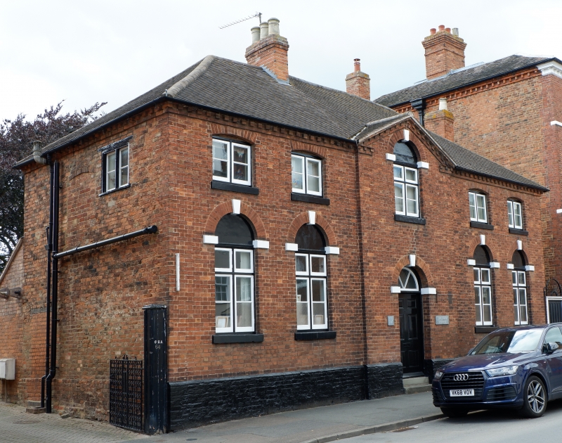
Former ancillary building to No.60, now house and school. Early C19 with later alterations. Red brick in Flemish bond. Hipped renewed clay-tile roof with stepped dentilled eaves and brick stacks, one to ridge and one lateral. EXTERIOR: 2 storeys. 5-window range, central pedimented bay breaking forward. 1st floor: windows are 2-light 2-pane casements with segmental brick arches and projecting sills except for central window which has mullion and transom, single-pane overlights and 2-pane casements below, rendered tympanum below tall round brick arch with springers and keystone, and projecting sill. Ground floor: windows similar to that below pediment; central similarly-arched entrance having fanlight with radial glazing bars, 6-panel door, and 2 stone steps; painted brick plinth. INTERIOR: not inspected.
Listing NGR: SO9506745498
External links are from the relevant listing authority and, where applicable, Wikidata. Wikidata IDs may be related buildings as well as this specific building. If you want to add or update a link, you will need to do so by editing the Wikidata entry.


Other nearby listed buildings