Approximate Location Map
Large Map »
Latitude: 50.7907 / 50°47'26"N
Longitude: -1.1088 / 1°6'31"W
OS Eastings: 462910
OS Northings: 99388
OS Grid: SZ629993
Mapcode National: GBR VN6.JV
Mapcode Global: FRA 87K0.3TZ
Plus Code: 9C2WQVRR+7F
Entry Name: Bollard on North Side of Round Tower
Listing Date: 18 March 1999
Grade: II
Source: Historic England
Source ID: 1387244
English Heritage Legacy ID: 475176
ID on this website: 101387244
Location: Old Portsmouth, Portsmouth, Hampshire, PO1
County: City of Portsmouth
Electoral Ward/Division: St Thomas
Parish: Non Civil Parish
Built-Up Area: Portsmouth
Traditional County: Hampshire
Lieutenancy Area (Ceremonial County): Hampshire
Church of England Parish: St Thomas of Canterbury, Portsmouth
Church of England Diocese: Portsmouth
Tagged with: Bollard
PORTSMOUTH
SZ6299 TOWER STREET, The Point
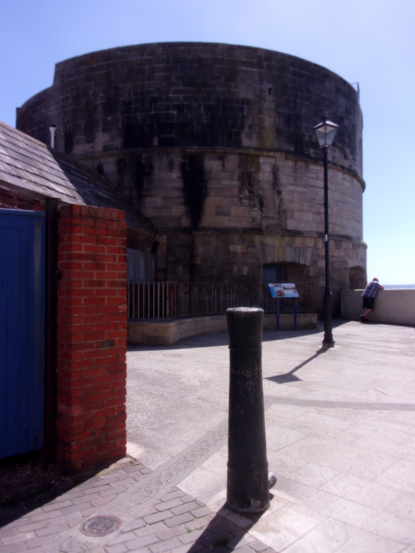
774-1/11/460 Bollard on north side of Round Tower
GV II
Cannon barrel, now bollard. Date engraved on barrel 1708.
Reused as bollard probably mid-late C19. Cast-iron. Tapering
barrel set on end.
Listing NGR: SZ6289499522
External links are from the relevant listing authority and, where applicable, Wikidata. Wikidata IDs may be related buildings as well as this specific building. If you want to add or update a link, you will need to do so by editing the Wikidata entry.


Other nearby listed buildings
