Approximate Location Map
Large Map »
Latitude: 53.5959 / 53°35'45"N
Longitude: -2.4492 / 2°26'56"W
OS Eastings: 370369
OS Northings: 411128
OS Grid: SD703111
Mapcode National: GBR CVBV.KP
Mapcode Global: WH97N.BWZ6
Plus Code: 9C5VHHW2+98
Entry Name: Stork Tavern
Listing Date: 26 April 1974
Last Amended: 30 April 1999
Grade: II
Source: Historic England
Source ID: 1388055
English Heritage Legacy ID: 476053
ID on this website: 101388055
Location: Smithills, Bolton, Greater Manchester, BL1
County: Bolton
Electoral Ward/Division: Crompton
Parish: Non Civil Parish
Built-Up Area: Bolton
Traditional County: Lancashire
Lieutenancy Area (Ceremonial County): Greater Manchester
Church of England Parish: West Bolton
Church of England Diocese: Manchester
Tagged with: Pub
This List entry was subject to a Minor Amendment on 16/02/2018
SD 7011 SW; 797-1/9/107
BOLTON,
HALLIWELL ROAD (North side),
No. 548,
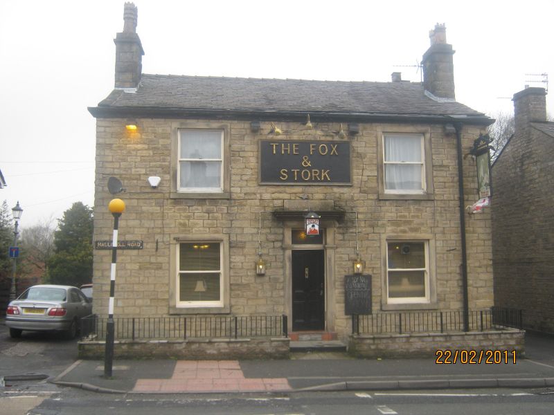
Stork Tavern
(Formerly listed as: Fox and Stork Public House; Previously Listed as: HALLIWELL ROAD Nos 522-546 (even). No 548 (Stork Tavern))
26/04/74
GV
II
Public house. c1850. Coursed and squared stone with slate
roof.
EXTERIOR AND PLAN: Two storeys, 2-window range with central
entrance; double pile plan. Doorway in moulded architrave with
overlight. 2-pane sashes in unmoulded architraves on each
floor, and a single 12-pane sash window in left hand gable
return. Moulded wood eaves. End wall stacks, forward of the
ridge line.
INTERIOR: not inspected.
Listing NGR: SD7036911128
External links are from the relevant listing authority and, where applicable, Wikidata. Wikidata IDs may be related buildings as well as this specific building. If you want to add or update a link, you will need to do so by editing the Wikidata entry.


Other nearby listed buildings
