Latitude: 53.3068 / 53°18'24"N
Longitude: -2.3723 / 2°22'20"W
OS Eastings: 375287
OS Northings: 378932
OS Grid: SJ752789
Mapcode National: GBR CZW6.6B
Mapcode Global: WH997.J4KT
Plus Code: 9C5V8J4H+P3
Entry Name: 10, 11 and 12, Drury Lane
Listing Date: 12 October 1971
Last Amended: 27 May 1999
Grade: II
Source: Historic England
Source ID: 1388330
English Heritage Legacy ID: 476338
ID on this website: 101388330
Location: Knutsford, Cheshire East, Cheshire, WA16
County: Cheshire East
Civil Parish: Knutsford
Built-Up Area: Knutsford
Traditional County: Cheshire
Lieutenancy Area (Ceremonial County): Cheshire
Church of England Parish: Knutsford St John the Baptist
Church of England Diocese: Chester
Tagged with: Building
KNUTSFORD
SJ7478 DRURY LANE 792-1/3/19 (South side) 12/10/71 Nos.10, 11 AND 12 (Formerly Listed as: DRURY LANE Nos.4-13 (Consecutive) Old Laundry (formerly listed as workshop between 8 & 9). Water Tower & Chimney)
GV II
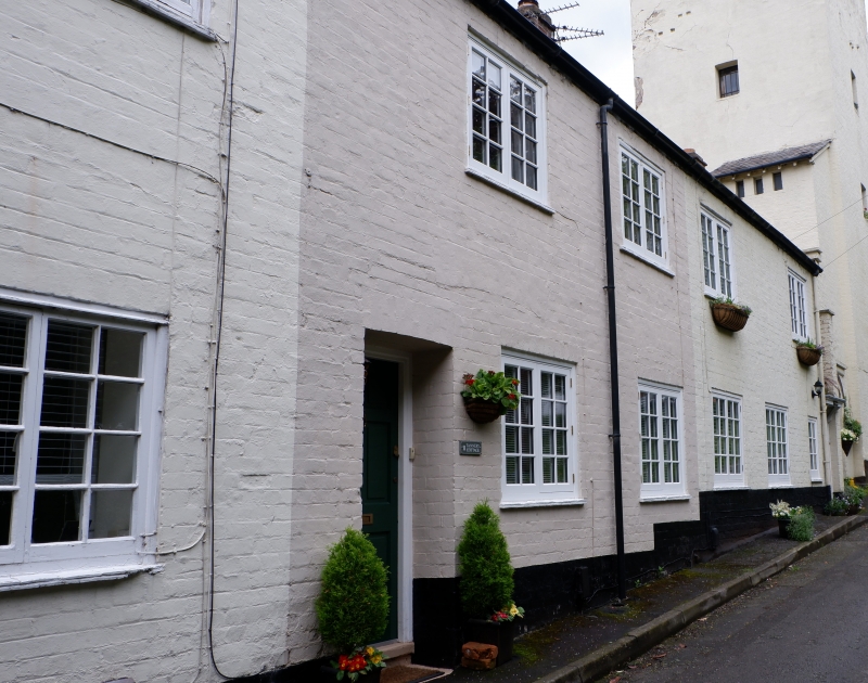
Dye-works, now 3 cottages. Converted for domestic use c1900 by Richard Harding Watt. Painted brick with Welsh slate roofs. 2 storeys, 6-window range. Doorways towards left and centre, and in single-storey porch to side in right-hand unit. Windows are all renewed casements with segmental relieving arches to ground floor, and flat-arched heads to first floor. Many lower openings cut earlier openings, the earlier brick arched heads still visible. Doorways to left and centre recessed. Larger original openings in rear wall now infilled, the heavy timber lintels surviving. INTERIOR: not inspected. Part of a remarkable development in Free Style built under the patronage of Richard Harding Watt.
Listing NGR: SJ7528778932
External links are from the relevant listing authority and, where applicable, Wikidata. Wikidata IDs may be related buildings as well as this specific building. If you want to add or update a link, you will need to do so by editing the Wikidata entry.


Other nearby listed buildings