Approximate Location Map
Large Map »
Latitude: 53.3067 / 53°18'24"N
Longitude: -2.3721 / 2°22'19"W
OS Eastings: 375298
OS Northings: 378931
OS Grid: SJ752789
Mapcode National: GBR CZW6.7B
Mapcode Global: WH997.J4MT
Plus Code: 9C5V8J4H+M4
Entry Name: 13, Drury Lane
Listing Date: 12 October 1971
Last Amended: 27 May 1999
Grade: II
Source: Historic England
Source ID: 1388331
English Heritage Legacy ID: 476339
ID on this website: 101388331
Location: Knutsford, Cheshire East, Cheshire, WA16
County: Cheshire East
Civil Parish: Knutsford
Built-Up Area: Knutsford
Traditional County: Cheshire
Lieutenancy Area (Ceremonial County): Cheshire
Church of England Parish: Knutsford St John the Baptist
Church of England Diocese: Chester
Tagged with: House
KNUTSFORD
SJ7478 DRURY LANE
792-1/3/20 (South side)
12/10/71 No.13
(Formerly Listed as:
DRURY LANE
Nos.4-13 (Consecutive)
Old Laundry (formerly listed as
workshop between 8 & 9). Water Tower
& Chimney)
GV II
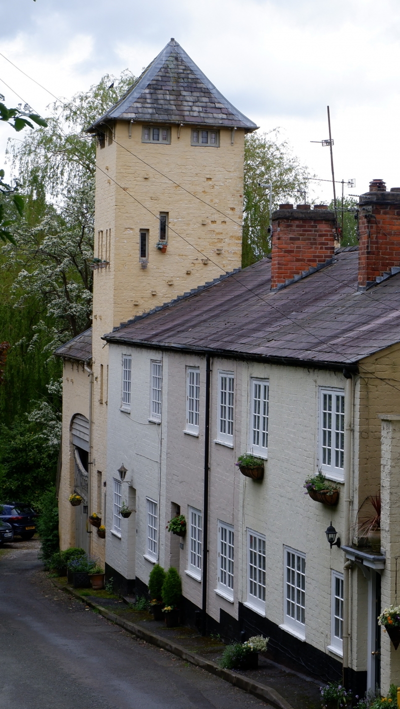
Tower house. c1900. By Richard Harding Watt. Painted brick
with low pyramidal slate roof overhanging on struts. Severe
Germanic style.
4-storeyed with open upper storey. Arched entrance in return
elevation, and narrow windows paired in the upper storey,
single lights in ground and first floors. Small 2-storeyed
cottage extension beyond return elevation, with full-height
squared bay window. High entrance arch to left, in wall with
hipped roof overhanging on struts, and wide segmentally-arched
entrance with wooden main and side gates with Art
Nouveau-style iron work.
INTERIOR: not inspected.
HISTORY: the tower formed part of a complex including laundry
and workers' cottages established by Watt on the site of a dye
works and tannery. Part of a remarkable development in Free
Style built under the patronage of Richard Harding Watt.
Listing NGR: SJ7529878931
External links are from the relevant listing authority and, where applicable, Wikidata. Wikidata IDs may be related buildings as well as this specific building. If you want to add or update a link, you will need to do so by editing the Wikidata entry.


Other nearby listed buildings
