Approximate Location Map
Large Map »
Latitude: 51.3853 / 51°23'6"N
Longitude: -2.3688 / 2°22'7"W
OS Eastings: 374432
OS Northings: 165198
OS Grid: ST744651
Mapcode National: GBR 0QH.1Y1
Mapcode Global: VH96L.WFLX
Plus Code: 9C3V9JPJ+3F
Entry Name: Bandstand
Listing Date: 5 August 1975
Last Amended: 15 October 2010
Grade: II
Source: Historic England
Source ID: 1394742
English Heritage Legacy ID: 510145
ID on this website: 101394742
Location: Royal Victoria Park, Kingsmead, Bath and North East Somerset, Somerset, BA1
County: Bath and North East Somerset
Parish: Non Civil Parish
Built-Up Area: Bath
Traditional County: Somerset
Lieutenancy Area (Ceremonial County): Somerset
Church of England Parish: Bath St Michael Without
Church of England Diocese: Bath and Wells
Tagged with: Bandstand
ROYAL VICTORIA PARK
656-1/29/1430
Bandstand
(Formerly Listed as:
VICTORIA PARK Bandstand)
05/08/75
GV II
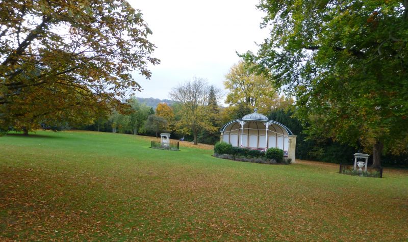
Bandstand. c1887. By Major Charles Davis.
MATERIALS: Limestone ashlar plinth and rear, cast iron columns supporting lead fish scale roof, timber lining to interior. Semi elliptical plan with rectangular block to rear. Shallow coved semi elliptical roof has elliptical dome to centre, dentil fascia curves to follow the contours, and rests on flanking pilasters with dentil cornices. Two columns to each side of central dome have elaborate scrolled tops with lyre motifs, and moulded bases. Fronting stage is a cast iron trellised balustrade. Rear of inside divided into nine horizontally planked panels with vertical ribs converging at base of dome, between ribs segmental arched panels to base concealing jib door to left of centre. Four windows to rear.
HISTORY: This is a relatively unusual type of bandstand, designed with acoustic principles firmly in mind. It is axially aligned with the centre of the Royal Crescent. Victoria Park was laid out in 1830 on the former Barton Fields, an area of common land and was opened by the Duchess of Kent with her daughter, Princess Victoria, on October 23rd 1830. It was the country's first municipal park.
Listing NGR: ST7443265198
External links are from the relevant listing authority and, where applicable, Wikidata. Wikidata IDs may be related buildings as well as this specific building. If you want to add or update a link, you will need to do so by editing the Wikidata entry.


Other nearby listed buildings
