Approximate Location Map
Large Map »
Latitude: 51.3825 / 51°22'56"N
Longitude: -2.3622 / 2°21'43"W
OS Eastings: 374891
OS Northings: 164887
OS Grid: ST748648
Mapcode National: GBR 0QH.9M1
Mapcode Global: VH96M.0JK1
Plus Code: 9C3V9JJQ+X4
Entry Name: 15, 16 and 17, Trim Street
Listing Date: 11 August 1972
Last Amended: 15 October 2010
Grade: II
Source: Historic England
Source ID: 1395405
English Heritage Legacy ID: 510811
ID on this website: 101395405
Location: Bath, Bath and North East Somerset, Somerset, BA1
County: Bath and North East Somerset
Parish: Non Civil Parish
Built-Up Area: Bath
Traditional County: Somerset
Lieutenancy Area (Ceremonial County): Somerset
Church of England Parish: Bath St Michael Without
Church of England Diocese: Bath and Wells
Tagged with: Building
TRIM STREET
656-1/40/1701 (South side)
Nos.15, 16 AND 17
11/08/72
GV II
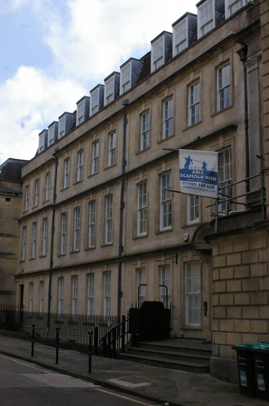
Three houses, now offices. Dated 1724, restored 1897 and following wartime damage with C20 alterations. Thomas Greenway has been suggested as architect.
MATERIALS: Limestone ashlar, double Roman tile roof. fine terrace, set back from properties at each end, fronts restored in conjunction with restructuring of interior, former list refers to wide openings for vehicle access at ground floor level.
EXTERIOR: Three storeys, attic and basement, eleven windows, all twelve-pane sashes, in moulded architraves with keystones rising at each floor to moulded full-width cornice, high C20 mansard roof has eleven twelve-pane sash dormers, and basement, in painted rubble, has six plain sashes and two doors. To left tall six-panel door in architrave with key, and to right similar door in deep reveals, on wide landing to three steps, with architrave, with fine shell hood on shaped brackets to pilasters. Top cornice, with blocking course and parapet, broken and slightly stepped up between bays three and four, end walls coped, and no stacks. Three lead downpipes, central one on broad pilaster, and above ground floor bay seven inscribed dates 1724 and 1897.
INTERIOR: Not inspected, but thought to be totally reconstructed (past Ordnance Survey maps have marked these houses as warehousing).
SUBSIDIARY FEATURES: Basement area enclosed by simple railings on ashlar curb, returned at ends to doorways.
HISTORY: Part of the formal development of the south side of Trim Street, the second phase of the street's growth after the initial phase of 1707 on land owned by George Trim, just outside the mediaeval walls. A good group of town houses from the immediate pre-Wood phase of Bath building. The Street retains its flagged pavements and sett roadway. This part of the street has however lost the stone pavements and roadway still retained at its east end.
SOURCES: Walter Ison, 'The Georgian Buildings of Bath' (2nd ed. 1980), 104; Howard Colvin, 'A Biographical Dictionary of British Architects 1660-1840' (2nd ed 1978), 364.
Listing NGR: ST7489464884
External links are from the relevant listing authority and, where applicable, Wikidata. Wikidata IDs may be related buildings as well as this specific building. If you want to add or update a link, you will need to do so by editing the Wikidata entry.


Other nearby listed buildings
