Approximate Location Map
Large Map »
Latitude: 51.3864 / 51°23'11"N
Longitude: -2.3602 / 2°21'36"W
OS Eastings: 375027
OS Northings: 165327
OS Grid: ST750653
Mapcode National: GBR 0QH.429
Mapcode Global: VH96M.1FL0
Plus Code: 9C3V9JPQ+HW
Entry Name: 6, Vineyards
Listing Date: 11 August 1972
Last Amended: 15 October 2010
Grade: II
Source: Historic England
Source ID: 1395497
English Heritage Legacy ID: 510903
ID on this website: 101395497
Location: Bath, Bath and North East Somerset, Somerset, BA1
County: Bath and North East Somerset
Parish: Non Civil Parish
Built-Up Area: Bath
Traditional County: Somerset
Lieutenancy Area (Ceremonial County): Somerset
Tagged with: Building
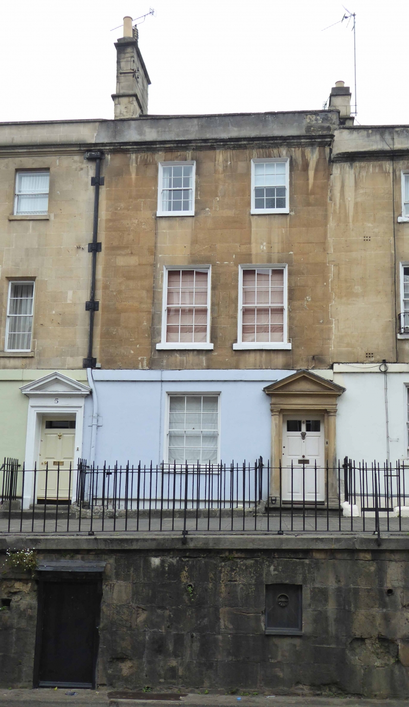
VINEYARDS
656-1/31/1757
No.6
(Formerly Listed as:
THE VINEYARDS Nos.1-7 (Consec))
11/08/72
GV II
House. c1770. Developed by Thomas Omer.
MATERIALS: Limestone ashlar to front, painted to ground floor, rubble to basement, double pile parapeted roof, Welsh Slate to front, not visible to rear, coped party wall to left with two ashlar stacks with some early clay pots.
EXTERIOR: Three storeys and basement, two-window front. First floor has two plate glass horned sashes in splayed reveals with lowered stone sills. Second floor has two plate glass sashes in splayed reveals with stone sills. Ground floor has two/two horned sash in splayed reveal with stone sill to left, to right six-panel door with fielded and glazed panels in pedimented Doric doorcase. Two Pennant steps to crossover with cast iron footscraper. Basement has two-light glazing bar casement, door under crossover not visible. Band course over ground floor continuous with No.5 Vineyards (qv), moulded eaves cornice and coped parapet continuous with Nos 1-5 Vineyards (qv). Lead hopperhead and downpipe attached to left shared with No.5 Vineyards. Rear elevation not visible.
INTERIOR: Not inspected.
SUBSIDIARY FEATURES: Attached wrought iron railings and gate with shaped heads on limestone bases.
HISTORY: This stands on ground formerly the property of Hayne family from 1638 when Thomas Hayne bought it from William Snygge; it passed by inheritance to Charles Hayne in 1750 who cleared it of mortgage and other encumbrances, and by 1756 plans to sell Vineyards to Thomas Omer for building had reached an advanced stage. These were not finally realised until an indenture of 26 February 1765, in which Charles Hayne sold to Thomas Omer, Gent and Thomas Jelly, Carpenter his trustee, the site of Vineyards for building at yearly rent of £50. Belmont was constructed on west edge of same ground. Vineyards had previously been used as a vineyard until c1730 when the springs, which watered it began to fail. The row to north of the Countess of Huntingdon's Chapel was originally called Harlequin Row because of unusual use of brick and stone in construction.
SOURCES: Bath Archaeological Trust/RCHM England: Georgian Bath Historical Map: Southampton: 1989-.
Listing NGR: ST7502765327
External links are from the relevant listing authority and, where applicable, Wikidata. Wikidata IDs may be related buildings as well as this specific building. If you want to add or update a link, you will need to do so by editing the Wikidata entry.


Other nearby listed buildings
