Latitude: 51.4272 / 51°25'37"N
Longitude: -2.5442 / 2°32'39"W
OS Eastings: 362258
OS Northings: 169934
OS Grid: ST622699
Mapcode National: GBR CMW.F7
Mapcode Global: VH88V.VDB9
Plus Code: 9C3VCFG4+V8
Entry Name: Bristol War Room
Listing Date: 25 March 2013
Last Amended: 20 May 2025
Grade: II*
Source: Historic England
Source ID: 1411750
ID on this website: 101411750
Location: Brislington, Bristol, BS4
County: City of Bristol
Electoral Ward/Division: Brislington West
Parish: Non Civil Parish
Built-Up Area: Bristol
Traditional County: Somerset
Lieutenancy Area (Ceremonial County): Bristol
Church of England Parish: Brislington St Luke
Church of England Diocese: Bristol
Tagged with: Architectural structure
This semi-sunken hardened concrete building was completed in 1953 as part of a network designed by the Ministry of Works to protect the functions of regional government in the event of nuclear attack and to co-ordinate the country’s civil defence. Never required for its intended use, the war room was fitted out to provide accommodation and communication capabilities for a group of men and women to coordinate disaster recovery. The building was taken out of use as disaster management policy changed, latterly used for storage, and in the C21 the wider site has been redeveloped. Most removable equipment and asbestos cement fittings have been taken away, however, the main operational accommodation facilities and fittings remain.
Regional War Room of 1953, established to co-ordinate civil defence in the event of an atomic attack and to protect regional government. Designed by the Ministry of Works.
MATERIALS: it is built of reinforced concrete using the continuous pour technique, the floor slab, walls and roof can be considered as being one. The walls are rendered above plain concrete footings and covered with deliberately planted Virginia creeper.
PLAN: a rectangular-plan, semi-sunken reinforced concrete building of two-storeys: the lower floor of which is below ground-level. It is entered by two opposing entrances in the north-east and south-west elevations each leading to a pair of stairs and continuous circulatory corridors that provide access to all rooms on both floors. The plan centres around the map/ operations room with control cabins on its south-eastern and south-western sides.
EXTERIOR: plain concrete elevations under an oversailing parapet with the only openings being two door entrances, both fronted by semi-circular concrete hardstandings. No.1 entrance is at the eastern end of the south-west elevation, while No.2 entrance at the eastern end of the north-east elevation. There are three concrete-shrouded ventilator towers at the east end of the flat roof, over the plant rooms. There is a small drain lid set in the grass to the northeast of the war room with brick edging.
INTERIOR: a utilitarian interior lacking in decorative features and retaining 1950s fittings and fixtures. Both entrances and lead into a dog-leg plan blast-baffle with a heavy steel blast door set at right angles to the entrance. No.1 entrance acted as the main point of entry to the upper floor and is flanked by a security room that has a ‘Lamson’ message delivery system linked to the lower floor. It has a rope pulley system and a timber cabinet. A pair of concrete staircases on either side of the building, situated close to the entrances lead down to the lower floor. The stairs have concrete steps with linoleum inset treads, solid concrete central balustrades and painted steel handrails. A painted black metal water tank rests on a concrete shelf sits over the landing of each staircase.
There is a range of rooms off the upper circulatory corridor including offices, a kitchen and canteen, dormitories and washrooms with toilets and showers. The canteen and washrooms retain fittings. The stand-by generator room is situated within the plant room and houses a diesel engine powered dynamo of 1953. The plant room contains an air conditioning unit, electrical equipment, timber battery shelves, fuse boxes and switch panels with armoured cabling. To the rear of the plant room is a floor access panel to a service gulley. On the inner side of the south-eastern arm of the corridor, are two rooms with curved anti-reflection glass windows that look down into the ‘well’ of the map room below. The smaller room was allocated to the Civil Defence Officer, and the larger one was for the County Controller; however, the sign on one door into this room reads Fire Control Room.
The lower floor circulatory corridor provides access into the well of the two-storey high map room. There is a large wall map of the Bristol area dating from 1980s and a resources blackboard on the north-west wall. The south-east wall has six curved anti-reflection glass windows, three to each floor, and the south-west wall has one window at the lower floor level. A hinged glazed message transfer box is fitted into the left-hand corner of the frames of each of the lower floor windows.
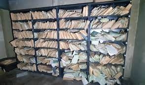
Rooms are served by the lower corridor, including further offices, GPO equipment room, administration control, signals, and two tank rooms. On the north-western side is the signals room which has been sub-divided into three areas, one has a bench that has sixteen acoustic booths with drawers. The switchboard/teleprinter room, sits within the larger signals room, and has a message passing hatch in its end wall. Some racking and electrical equipment, heating and floor linoleum, is in situ in the rear signals offices.
The timber doors throughout all have plain flat surfaces, some with ventilation panels at their base. Most have painted numbering and some naming the room function, such as CANTEEN. Door furniture is largely of black Bakelite. Most electrical and light fittings are original. Round Tannoy public address system speakers are attached to the walls in a number of the rooms.
As the perceived threat of nuclear conflict emerged following the end of the Second World War, the UK government agreed a strategy for civil defence. In the event of an attack, the administration of England would be divided into ten regions in case central government was disrupted or destroyed. Each region was given a hardened Regional War Room (and 4 in London) from which a regional commissioner would govern until normal conditions were restored. All except one of these war rooms (in Newcastle-upon-Tyne) was a purpose-built structure, and they were usually located on government estates alongside the offices of other ministries.
The war room designs were in development from October 1951, with construction work starting shortly afterwards and completion in 1956. Each comprised a reinforced concrete structure with massive external walls (1.45m) and roof (1.52m) and further reinforced concrete internal partition walls as well as its own generators, air filtration system and water supply. The function of the war rooms was to gather information in the event of an attack and to co-ordinate rescue and welfare facilities in support of regional government. There were three different designs: single-storey surface buildings; two-storey surface buildings; and two-storey semi-sunken buildings, as at Bristol. On plan they were broadly similar with a central map/operations room and adjacent control rooms, offices and communications rooms, as well as ablutions, dormitories and a canteen. The buildings provided protection for approximately 50 staff.
The Bristol War Room was completed in 1953 and was in Home Defence Region 7, which covered Cornwall, Devon, Gloucestershire, Somerset and Wiltshire. It was built at the southern end of the former government estate at Brislington, since redeveloped for housing. Later, in the early 1960s, a national civil defence strategy implemented Regional Seats of Government (RSGs) that were better equipped to cope with the hydrogen bomb. While some war rooms were converted to RSGs, Bristol Regional War Room was rented by Avon County Council from the Home Office as their County Borough Control building until 1981. Subsequently, it was used for storage and then, in the C21, had most removable equipment and asbestos cement fittings taken away. In 2025, many fixtures including lighting and other electrical equipment including plant, viewing windows to the map room, Lamson message system, desks and sanitation equipment remain in situ.
Bristol War Room, completed in 1953, is listed at Grade II* for the following principal reasons:
Historic interest:
* built to the first nuclear-proof design intended for civilian occupation in Great Britain, and marks the strategic transition in the post-war British Government’s appreciation of the effects of nuclear warfare;
* a rare survival of a purpose-built war room, built to the two-storey semi-sunken design, constructed during the early 1950s;
* the structure is remarkably intact with only one major phase of alteration since built, as well as the removal of harmful materials in the C21;
* it is the best surviving example of the building type and continues to legibly demonstrate its Cold War functions down to the usage of many areas and the division of facilities for female and male occupants.
Architectural interest:
* a building which expresses through its monumental and robust form the threat posed by the atomic bomb and the necessary measures to protect its occupants from the effects of nuclear attack.
External links are from the relevant listing authority and, where applicable, Wikidata. Wikidata IDs may be related buildings as well as this specific building. If you want to add or update a link, you will need to do so by editing the Wikidata entry.


Other nearby listed buildings