Approximate Location Map
Large Map »
Latitude: 56.7024 / 56°42'8"N
Longitude: -5.5688 / 5°34'7"W
OS Eastings: 181622
OS Northings: 762431
OS Grid: NM816624
Mapcode National: GBR DCM0.9YR
Mapcode Global: WH0DZ.FSDR
Plus Code: 9C8PPC2J+XF
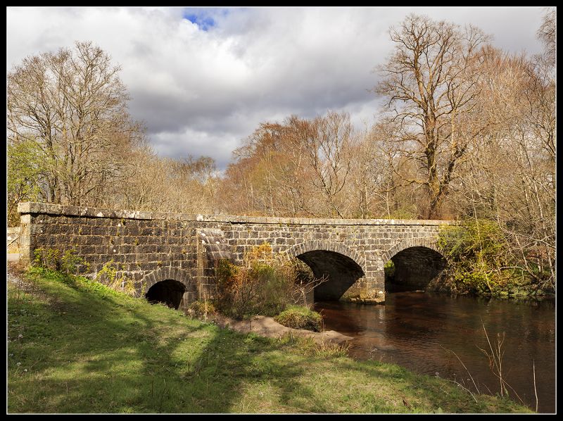
Entry Name: Drumnatorran Bridge, Strontian
Listing Name: Strontian, Drumnatorran Bridge over Strontian River
Listing Date: 29 May 1985
Category: C
Source: Historic Scotland
Source ID: 330816
Historic Scotland Designation Reference: LB510
Building Class: Cultural
ID on this website: 200330816
Location: Ardnamurchan
County: Highland
Electoral Ward: Fort William and Ardnamurchan
Parish: Ardnamurchan
Traditional County: Argyllshire
Tagged with: Bridge Road bridge Stone arch bridge
Earlier-mid 19th century, twin arched bridge; roughly squared
granite rubble, tooled granite dressings. Dressed granite
arch rings and triangular cutwaters; dressed squared cope;
end buttresses to both sides of bridge; splayed approaches.
Approximate span of each arch - 20'.
External links are from the relevant listing authority and, where applicable, Wikidata. Wikidata IDs may be related buildings as well as this specific building. If you want to add or update a link, you will need to do so by editing the Wikidata entry.


Other nearby listed buildings
