Approximate Location Map
Large Map »
Latitude: 55.4351 / 55°26'6"N
Longitude: -2.7316 / 2°43'53"W
OS Eastings: 353802
OS Northings: 615933
OS Grid: NT538159
Mapcode National: GBR 95CL.DH
Mapcode Global: WH7XH.0NH7
Plus Code: 9C7VC7P9+28
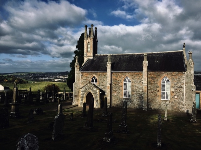
Entry Name: Cavers Parish Church
Listing Name: Cavers Church and Graveyard
Listing Date: 16 March 1971
Category: B
Source: Historic Scotland
Source ID: 332871
Historic Scotland Designation Reference: LB2044
Building Class: Cultural
ID on this website: 200332871
Location: Cavers
County: Scottish Borders
Electoral Ward: Hawick and Denholm
Parish: Cavers
Traditional County: Roxburghshire
Tagged with: Church building
1822; interior recast 1928.
External links are from the relevant listing authority and, where applicable, Wikidata. Wikidata IDs may be related buildings as well as this specific building. If you want to add or update a link, you will need to do so by editing the Wikidata entry.


Other nearby listed buildings
