Approximate Location Map
Large Map »
Latitude: 57.591 / 57°35'27"N
Longitude: -3.6944 / 3°41'39"W
OS Eastings: 298805
OS Northings: 856925
OS Grid: NH988569
Mapcode National: GBR K87N.JF1
Mapcode Global: WH5H9.7G0J
Plus Code: 9C9RH8R4+96
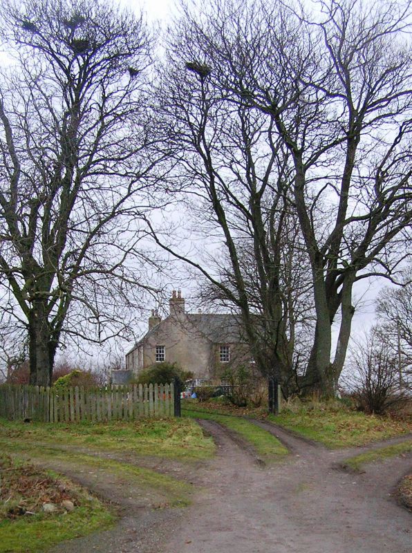
Entry Name: Old Tearie Farmhouse
Listing Name: Tearie Farmhouse
Listing Date: 9 November 1987
Category: C
Source: Historic Scotland
Source ID: 333184
Historic Scotland Designation Reference: LB2293
Building Class: Cultural
ID on this website: 200333184
Location: Dyke and Moy
County: Moray
Electoral Ward: Forres
Parish: Dyke And Moy
Traditional County: Morayshire
Tagged with: Farmhouse
Circa 1800. 2-storey, slightly irregular 3-bay S facing house
with 2 later parallel rear wings forming U-plan. Harled with
ashlar margins.
Near centre entrance masked by later gabled porch; single
ground and 1st floor windows in return gables; 2-bay rear
wings, 1 of 2 storeys, 1 of single storey and attic. Mainly
12-pane glazing; coped end stacks; slate roofs.
External links are from the relevant listing authority and, where applicable, Wikidata. Wikidata IDs may be related buildings as well as this specific building. If you want to add or update a link, you will need to do so by editing the Wikidata entry.


Other nearby listed buildings
