Approximate Location Map
Large Map »
Latitude: 55.9324 / 55°55'56"N
Longitude: -2.3628 / 2°21'46"W
OS Eastings: 377430
OS Northings: 671100
OS Grid: NT774711
Mapcode National: GBR NFJ1.28P
Mapcode Global: WH8WG.P41Y
Plus Code: 9C7VWJJP+XV
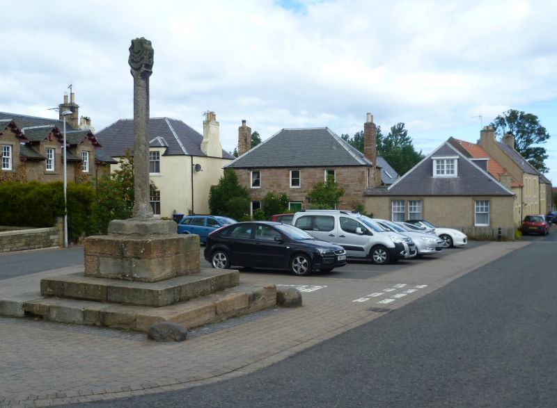
Entry Name: Market Cross, The Square, Cockburnspath
Listing Name: Market Cross Cockburnspath
Listing Date: 9 June 1971
Category: A
Source: Historic Scotland
Source ID: 335246
Historic Scotland Designation Reference: LB4047
Building Class: Cultural
Also known as: Cockburnspath, The Square, Market Cross
ID on this website: 200335246
Location: Cockburnspath
County: Scottish Borders
Electoral Ward: East Berwickshire
Parish: Cockburnspath
Traditional County: Berwickshire
Tagged with: Market cross
Irregularly stepped base of three tiers with shaft which is splayed at angles - Cross-head has carved thistle in relief on each side.
Scheduled Ancient Monument No 4267.
External links are from the relevant listing authority and, where applicable, Wikidata. Wikidata IDs may be related buildings as well as this specific building. If you want to add or update a link, you will need to do so by editing the Wikidata entry.


Other nearby listed buildings
