Approximate Location Map
Large Map »
Latitude: 56.73 / 56°43'48"N
Longitude: -2.5458 / 2°32'45"W
OS Eastings: 366699
OS Northings: 759949
OS Grid: NO666599
Mapcode National: GBR X1.75HM
Mapcode Global: WH8RH.V3WJ
Plus Code: 9C8VPFJ3+2M
Entry Name: Gateway, House Of Dun
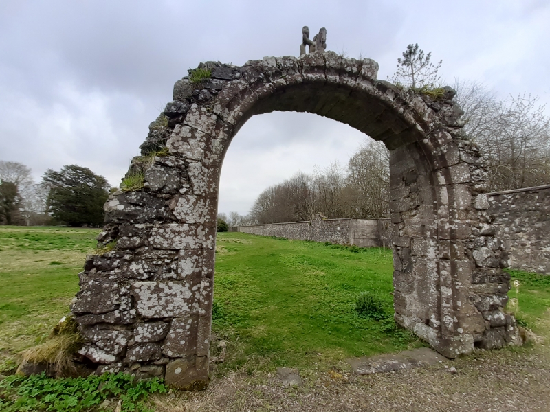
Listing Name: House of Dun Walled Garden. Gateway to Old House of Dun
Listing Date: 11 June 1971
Category: B
Source: Historic Scotland
Source ID: 335943
Historic Scotland Designation Reference: LB4664
Building Class: Cultural
Also known as: House Of Dun, Gateway
ID on this website: 200335943
Location: Dun
County: Angus
Electoral Ward: Montrose and District
Parish: Dun
Traditional County: Angus
Tagged with: Architectural structure
Semi-circular arch, about 10' wide with segmental rear
arch. Roll and hollow moulding. Largely overgrown.
External links are from the relevant listing authority and, where applicable, Wikidata. Wikidata IDs may be related buildings as well as this specific building. If you want to add or update a link, you will need to do so by editing the Wikidata entry.


Other nearby listed buildings
