Approximate Location Map
Large Map »
Latitude: 56.7275 / 56°43'38"N
Longitude: -2.5415 / 2°32'29"W
OS Eastings: 366965
OS Northings: 759665
OS Grid: NO669596
Mapcode National: GBR X2.H6JK
Mapcode Global: WH8RH.X5YG
Plus Code: 9C8VPFG5+XC
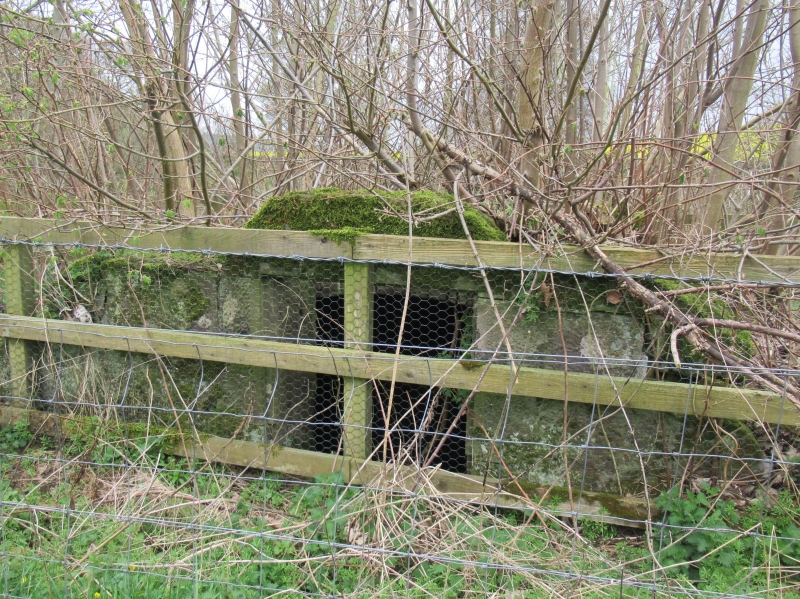
Entry Name: Icehouse, House Of Dun
Listing Name: House of Dun Icehouse (W. on Map Perhaps Wellhouse) S.s.w. of House
Listing Date: 11 June 1971
Category: B
Source: Historic Scotland
Source ID: 335947
Historic Scotland Designation Reference: LB4667
Building Class: Cultural
ID on this website: 200335947
Location: Dun
County: Angus
Electoral Ward: Montrose and District
Parish: Dun
Traditional County: Angus
Tagged with: Architectural structure
Square stone-built chamber with brick vault. Low entry.
18th cent.
External links are from the relevant listing authority and, where applicable, Wikidata. Wikidata IDs may be related buildings as well as this specific building. If you want to add or update a link, you will need to do so by editing the Wikidata entry.


Other nearby listed buildings
