Approximate Location Map
Large Map »
Latitude: 56.7289 / 56°43'44"N
Longitude: -2.5401 / 2°32'24"W
OS Eastings: 367047
OS Northings: 759823
OS Grid: NO670598
Mapcode National: GBR X2.H0VZ
Mapcode Global: WH8RH.Y4LC
Plus Code: 9C8VPFH5+HW
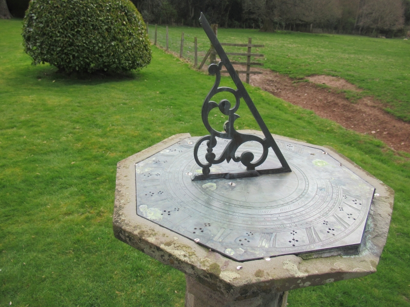
Entry Name: Sundial, House Of Dun
Listing Name: House of Dun Sundial
Listing Date: 11 June 1971
Category: B
Source: Historic Scotland
Source ID: 335977
Historic Scotland Designation Reference: LB4695
Building Class: Cultural
Also known as: House Of Dun, Sundial
ID on this website: 200335977
Location: Dun
County: Angus
Electoral Ward: Montrose and District
Parish: Dun
Traditional County: Angus
Tagged with: Sundial
Baluster type, fine engraved plate.
'ALX BRAND IN THE MINT EDINBURGH 1723.'
External links are from the relevant listing authority and, where applicable, Wikidata. Wikidata IDs may be related buildings as well as this specific building. If you want to add or update a link, you will need to do so by editing the Wikidata entry.


Other nearby listed buildings
