Approximate Location Map
Large Map »
Latitude: 56.375 / 56°22'29"N
Longitude: -3.9865 / 3°59'11"W
OS Eastings: 277411
OS Northings: 722066
OS Grid: NN774220
Mapcode National: GBR 19.2BCN
Mapcode Global: WH4N0.Q1V6
Plus Code: 9C8R92F7+X9
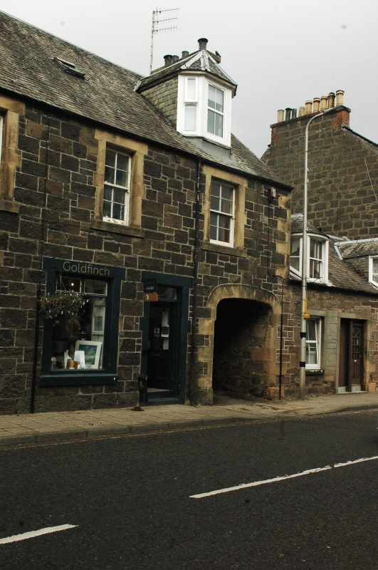
Entry Name: Malloch Buildings, Drummond Street, Comrie
Listing Name: Malloch Buildings, Drummond Street
Listing Date: 18 October 1977
Category: C
Source: Historic Scotland
Source ID: 336747
Historic Scotland Designation Reference: LB5329
Building Class: Cultural
ID on this website: 200336747
Location: Comrie
County: Perth and Kinross
Electoral Ward: Strathearn
Parish: Comrie
Traditional County: Perthshire
Tagged with: Architectural structure
Mid 19th century. 2-storey and attic, 4-window at 1st, 2
window and 2 doors alternated and semi-elliptical pend arch
at ground floor, dark local rubble with long and short
dressings. 2 canted dormers, slated roof.
External links are from the relevant listing authority and, where applicable, Wikidata. Wikidata IDs may be related buildings as well as this specific building. If you want to add or update a link, you will need to do so by editing the Wikidata entry.


Other nearby listed buildings
