Approximate Location Map
Large Map »
Latitude: 56.7747 / 56°46'28"N
Longitude: -3.8414 / 3°50'29"W
OS Eastings: 287565
OS Northings: 766305
OS Grid: NN875663
Mapcode National: GBR JBWT.92T
Mapcode Global: WH4KY.YZX9
Plus Code: 9C8RQ5F5+VC
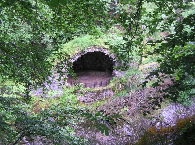
Entry Name: River Tilt Grotto
Listing Name: Grotto on River Tilt Opposite York Cascade
Listing Date: 5 October 1971
Category: A
Source: Historic Scotland
Source ID: 337582
Historic Scotland Designation Reference: LB6065
Building Class: Cultural
ID on this website: 200337582
Location: Blair Atholl
County: Perth and Kinross
Electoral Ward: Highland
Parish: Blair Atholl
Traditional County: Perthshire
Tagged with: Grotto
Large circular viewpoint half roofed by big semidome of
rustic masonry: gothic arches to footpaths: railed front
to viewpoint. 1758 (and 1773?)
External links are from the relevant listing authority and, where applicable, Wikidata. Wikidata IDs may be related buildings as well as this specific building. If you want to add or update a link, you will need to do so by editing the Wikidata entry.


Other nearby listed buildings
