Approximate Location Map
Large Map »
Latitude: 56.7757 / 56°46'32"N
Longitude: -3.841 / 3°50'27"W
OS Eastings: 287591
OS Northings: 766414
OS Grid: NN875664
Mapcode National: GBR JBWT.97V
Mapcode Global: WH4KY.ZY3K
Plus Code: 9C8RQ5G5+7H
Entry Name: East Lodge Road, Blair Castle Policies
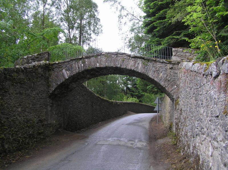
Listing Name: Foot Bridge and Adjoining Garden Walls over East Lodge Road Near Old Bridge of Tilt.
Listing Date: 9 June 1981
Category: C
Source: Historic Scotland
Source ID: 337583
Historic Scotland Designation Reference: LB6066
Building Class: Cultural
ID on this website: 200337583
Location: Blair Atholl
County: Perth and Kinross
Electoral Ward: Highland
Parish: Blair Atholl
Traditional County: Perthshire
Tagged with: Footbridge
Segmental arch, railed parapet. Probably 18th cent.
Group value only C Group.
Picturesque.
External links are from the relevant listing authority and, where applicable, Wikidata. Wikidata IDs may be related buildings as well as this specific building. If you want to add or update a link, you will need to do so by editing the Wikidata entry.


Other nearby listed buildings
