Approximate Location Map
Large Map »
Latitude: 56.767 / 56°46'1"N
Longitude: -3.8424 / 3°50'32"W
OS Eastings: 287480
OS Northings: 765449
OS Grid: NN874654
Mapcode National: GBR JBWT.W26
Mapcode Global: WH4L4.Y5FP
Plus Code: 9C8RQ585+R2
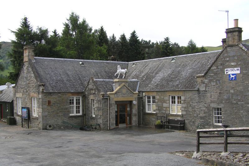
Entry Name: School, Blair Atholl
Listing Name: School and Schoolhouse, Blair Atholl
Listing Date: 9 June 1981
Category: C
Source: Historic Scotland
Source ID: 337605
Historic Scotland Designation Reference: LB6102
Building Class: Cultural
ID on this website: 200337605
Location: Blair Atholl
County: Perth and Kinross
Electoral Ward: Highland
Parish: Blair Atholl
Traditional County: Perthshire
Tagged with: School building
Schoolhouse single-storey and attic 3-window, single
storey school attached 1833: remodelled with additions
1865 (dated).
External links are from the relevant listing authority and, where applicable, Wikidata. Wikidata IDs may be related buildings as well as this specific building. If you want to add or update a link, you will need to do so by editing the Wikidata entry.


Other nearby listed buildings
