Approximate Location Map
Large Map »
Latitude: 56.7677 / 56°46'3"N
Longitude: -3.8409 / 3°50'27"W
OS Eastings: 287577
OS Northings: 765521
OS Grid: NN875655
Mapcode National: GBR JBWT.WWP
Mapcode Global: WH4L4.Z555
Plus Code: 9C8RQ595+3J
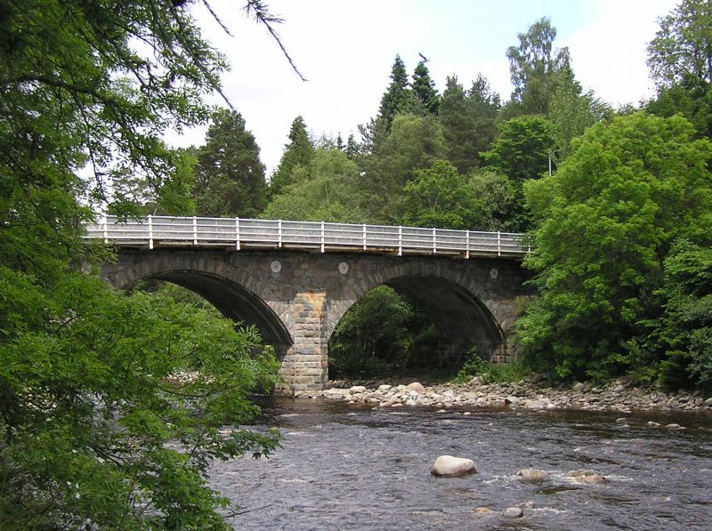
Entry Name: Bridge Of Tilt, Blair Atholl
Listing Name: Bridge of Tilt
Listing Date: 5 October 1971
Category: B
Source: Historic Scotland
Source ID: 337633
Historic Scotland Designation Reference: LB6109
Building Class: Cultural
Also known as: Blair Atholl, Bridge of Tilt
ID on this website: 200337633
Location: Blair Atholl
County: Perth and Kinross
Electoral Ward: Highland
Parish: Blair Atholl
Traditional County: Perthshire
Tagged with: Road bridge
3 segmental arches, large rubble in even courses, cut
waters. John Mitchell, C.E. 1823. Iron footpath added
recently on S.
External links are from the relevant listing authority and, where applicable, Wikidata. Wikidata IDs may be related buildings as well as this specific building. If you want to add or update a link, you will need to do so by editing the Wikidata entry.


Other nearby listed buildings
