Latitude: 57.5879 / 57°35'16"N
Longitude: -4.5375 / 4°32'14"W
OS Eastings: 248408
OS Northings: 858153
OS Grid: NH484581
Mapcode National: GBR H85N.VNW
Mapcode Global: WH3DM.8JKX
Plus Code: 9C9QHFQ7+52
Entry Name: Craigvar, Strathpeffer
Listing Name: Strathpeffer Craigivar
Listing Date: 31 August 1983
Category: C
Source: Historic Scotland
Source ID: 339844
Historic Scotland Designation Reference: LB7853
Building Class: Cultural
ID on this website: 200339844
Location: Fodderty
County: Highland
Electoral Ward: Wester Ross, Strathpeffer and Lochalsh
Parish: Fodderty
Traditional County: Cromartyshire
Tagged with: House
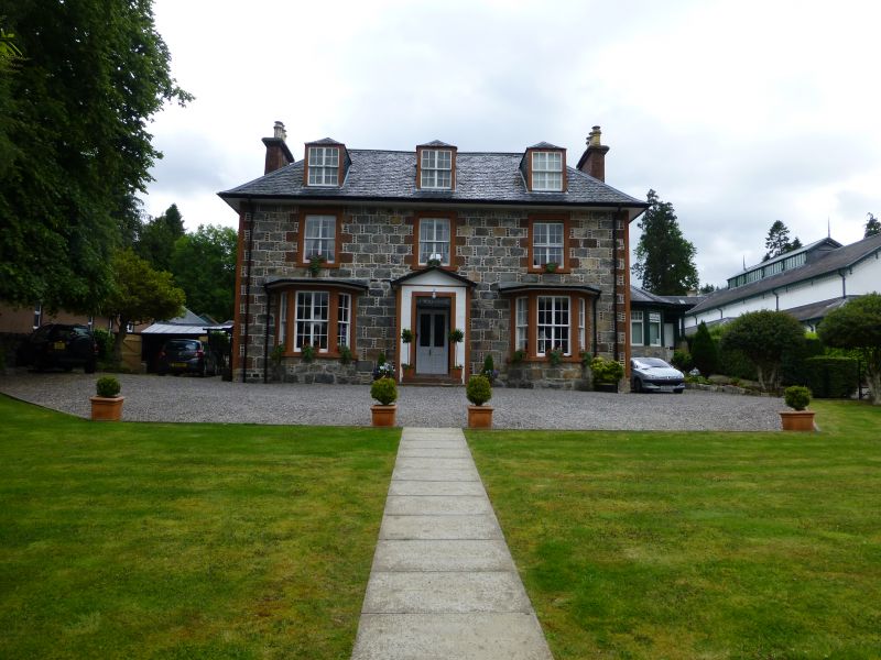
Mid/later 19th century; 2-storey and attic, 3-bay house;
coursed rubble frontage, with random rubble flanks;
contrasting red stone pinnings, margins and long-short
angles. Canted bay windows flank centre shallow gabled porch;
3 piended dormers; thick wooden centre mullions to all sash
windows; multi-pane glazing; corniced end stacks; piended
platform slate roof.
External links are from the relevant listing authority and, where applicable, Wikidata. Wikidata IDs may be related buildings as well as this specific building. If you want to add or update a link, you will need to do so by editing the Wikidata entry.


Other nearby listed buildings