Approximate Location Map
Large Map »
Latitude: 57.6568 / 57°39'24"N
Longitude: -4.3198 / 4°19'11"W
OS Eastings: 261680
OS Northings: 865353
OS Grid: NH616653
Mapcode National: GBR H8QH.011
Mapcode Global: WH3DB.MT53
Plus Code: 9C9QMM4J+P3
Entry Name: Barn, Kiltearn Parish Manse
Listing Name: Kiltearn Former Manse Barn
Listing Date: 25 March 1971
Category: C
Source: Historic Scotland
Source ID: 339919
Historic Scotland Designation Reference: LB7917
Building Class: Cultural
ID on this website: 200339919
Location: Kiltearn
County: Highland
Electoral Ward: Cromarty Firth
Parish: Kiltearn
Traditional County: Ross-shire
Tagged with: Barn
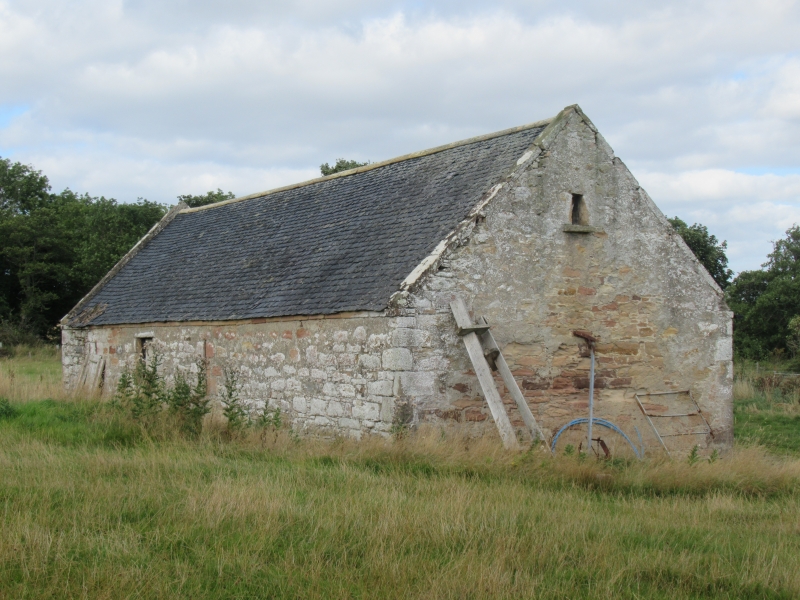
Late 18th/earlier 19th century, long rubble barn in field
NE of church; near centre winnowing doors in east and west
elevations flanked by long slit vents; later wide entrance
slapped in south bay of east elevation; slate roof.
External links are from the relevant listing authority and, where applicable, Wikidata. Wikidata IDs may be related buildings as well as this specific building. If you want to add or update a link, you will need to do so by editing the Wikidata entry.


Other nearby listed buildings
