Approximate Location Map
Large Map »
Latitude: 57.4499 / 57°26'59"N
Longitude: -2.7988 / 2°47'55"W
OS Eastings: 352159
OS Northings: 840231
OS Grid: NJ521402
Mapcode National: GBR M9G1.0L4
Mapcode Global: WH7LR.Z0DP
Plus Code: 9C9VC6X2+WF
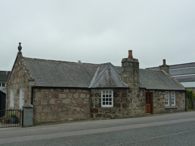
Entry Name: Binn Tollhouse, Huntly
Listing Name: Binn Toll House Huntly.
Listing Date: 11 September 1984
Category: C
Source: Historic Scotland
Source ID: 341330
Historic Scotland Designation Reference: LB9079
Building Class: Cultural
ID on this website: 200341330
Location: Huntly
County: Aberdeenshire
Electoral Ward: Huntly, Strathbogie and Howe of Alford
Parish: Huntly
Traditional County: Aberdeenshire
Tagged with: Tollhouse
Early 19th century, extended later, single-storey harled,
canted bay centre with stout coped chimney.
External links are from the relevant listing authority and, where applicable, Wikidata. Wikidata IDs may be related buildings as well as this specific building. If you want to add or update a link, you will need to do so by editing the Wikidata entry.


Other nearby listed buildings
