Approximate Location Map
Large Map »
Latitude: 56.8145 / 56°48'52"N
Longitude: -3.461 / 3°27'39"W
OS Eastings: 310904
OS Northings: 770172
OS Grid: NO109701
Mapcode National: GBR KBTQ.392
Mapcode Global: WH5M2.TZ29
Plus Code: 9C8RRG7Q+QH
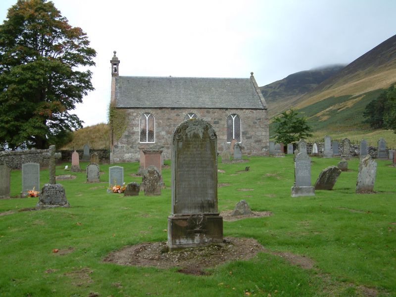
Entry Name: Burial Ground, Church, Spittal Of Glenshee
Listing Name: Glenshee Church Churchyard
Listing Date: 9 June 1981
Category: C
Source: Historic Scotland
Source ID: 346961
Historic Scotland Designation Reference: LB13763
Building Class: Cultural
ID on this website: 200346961
Location: Kirkmichael (Perth & Kinross)
County: Perth and Kinross
Electoral Ward: Blairgowrie and Glens
Parish: Kirkmichael (Perth & Kinross)
Traditional County: Perthshire
Tagged with: Cemetery Architectural structure
Rubble walled enclosure, some 18th and early 19th cent.
gravestones of interest.
External links are from the relevant listing authority and, where applicable, Wikidata. Wikidata IDs may be related buildings as well as this specific building. If you want to add or update a link, you will need to do so by editing the Wikidata entry.


Other nearby listed buildings
