Approximate Location Map
Large Map »
Latitude: 55.7255 / 55°43'31"N
Longitude: -4.8805 / 4°52'49"W
OS Eastings: 219201
OS Northings: 651765
OS Grid: NS192517
Mapcode National: GBR 30.D7K5
Mapcode Global: WH2NF.0C84
Plus Code: 9C7QP4G9+5R
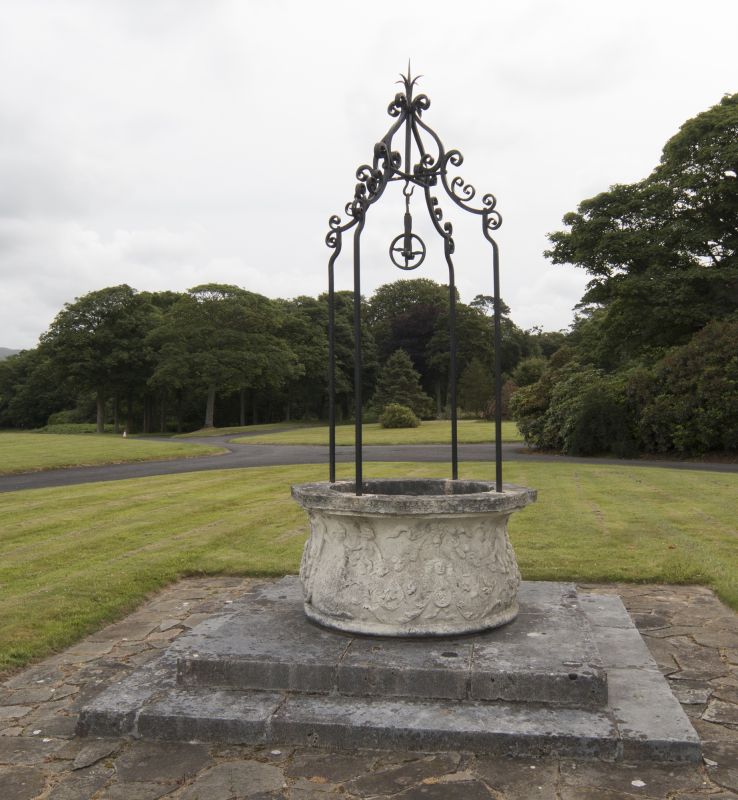
Entry Name: Well, Hunterston House
Listing Name: Well in Front of Mansion
Listing Date: 26 February 1980
Category: C
Source: Historic Scotland
Source ID: 347589
Historic Scotland Designation Reference: LB14287
Building Class: Cultural
ID on this website: 200347589
Location: West Kilbride
County: North Ayrshire
Electoral Ward: Dalry and West Kilbride
Parish: West Kilbride
Traditional County: Ayrshire
Tagged with: Well
Round stone well-head, wrot-iron standards, wheel and chain.
Has inscription inside.
External links are from the relevant listing authority and, where applicable, Wikidata. Wikidata IDs may be related buildings as well as this specific building. If you want to add or update a link, you will need to do so by editing the Wikidata entry.


Other nearby listed buildings
