Approximate Location Map
Large Map »
Latitude: 55.8177 / 55°49'3"N
Longitude: -3.247 / 3°14'49"W
OS Eastings: 321961
OS Northings: 658977
OS Grid: NT219589
Mapcode National: GBR 51R5.VB
Mapcode Global: WH6TC.313D
Plus Code: 9C7RRQ93+36
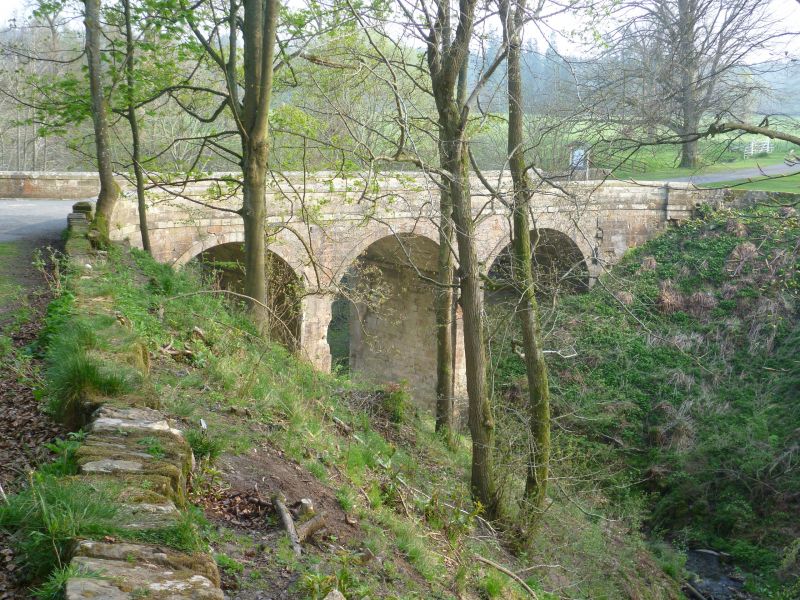
Entry Name: Bridge, River North Esk, Penicuik House, Penicuik
Listing Name: Bridge, River North Esk Penicuik Policies
Listing Date: 22 January 1971
Category: B
Source: Historic Scotland
Source ID: 348050
Historic Scotland Designation Reference: LB14637
Building Class: Cultural
ID on this website: 200348050
Location: Penicuik
County: Midlothian
Electoral Ward: Penicuik
Parish: Penicuik
Traditional County: Midlothian
Tagged with: Bridge Road bridge
19th (?) cent. 3 high segmental arches. Slab coping.
External links are from the relevant listing authority and, where applicable, Wikidata. Wikidata IDs may be related buildings as well as this specific building. If you want to add or update a link, you will need to do so by editing the Wikidata entry.


Other nearby listed buildings
