Approximate Location Map
Large Map »
Latitude: 55.9593 / 55°57'33"N
Longitude: -2.6076 / 2°36'27"W
OS Eastings: 362161
OS Northings: 674194
OS Grid: NT621741
Mapcode National: GBR 2Z.XG48
Mapcode Global: WH8W4.XGGX
Plus Code: 9C7VX95R+PX
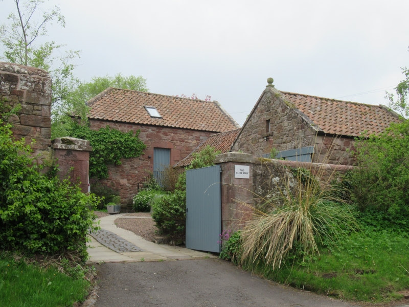
Entry Name: The Glebe Barn, Main Street, Stenton
Listing Name: Stenton, Main Street, Barn
Listing Date: 2 May 1990
Category: C
Source: Historic Scotland
Source ID: 348273
Historic Scotland Designation Reference: LB14805
Building Class: Cultural
ID on this website: 200348273
Location: Stenton
County: East Lothian
Electoral Ward: Dunbar and East Linton
Parish: Stenton
Traditional County: East Lothian
Tagged with: Architectural structure
Early 19th century. Rectangular-plan barn with pigsty
adjoined. Pink sandstone rubble, ashlar dressings.
Large door to N elevation at centre, flanked by ventilation
slit, and with remains of pigsty to right.
Pantiled piended-roof.
The large barn may belong to St Mary's, to W, or possibly
to Stenton House, at a greater distance to NE.
External links are from the relevant listing authority and, where applicable, Wikidata. Wikidata IDs may be related buildings as well as this specific building. If you want to add or update a link, you will need to do so by editing the Wikidata entry.


Other nearby listed buildings
