Approximate Location Map
Large Map »
Latitude: 55.959 / 55°57'32"N
Longitude: -2.6084 / 2°36'30"W
OS Eastings: 362114
OS Northings: 674160
OS Grid: NT621741
Mapcode National: GBR 2Z.XFYL
Mapcode Global: WH8W4.XH34
Plus Code: 9C7VX95R+HM
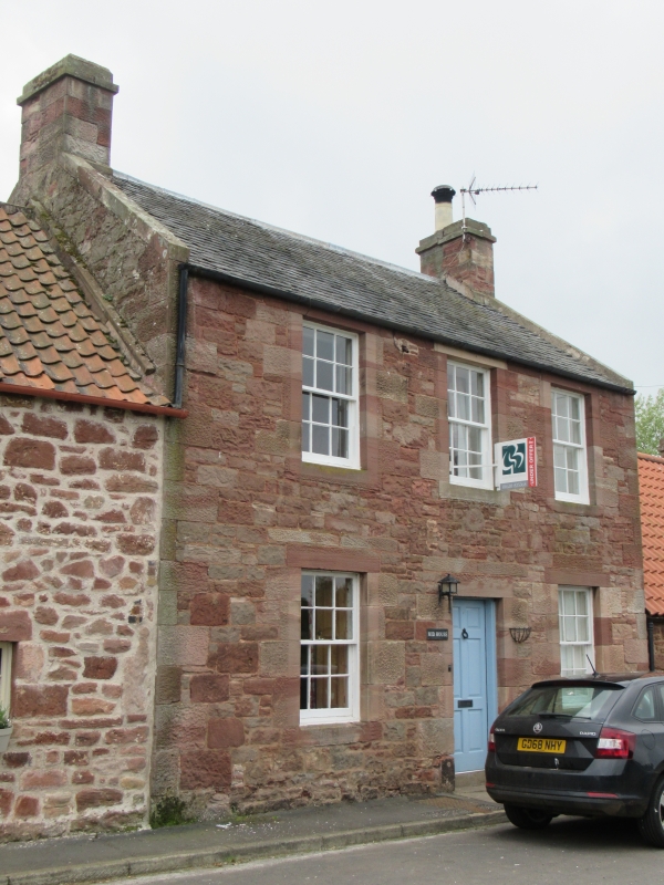
Entry Name: Mid House, Main Street, Stenton
Listing Name: Stenton, Main Street, Mid House
Listing Date: 2 May 1990
Category: B
Source: Historic Scotland
Source ID: 348276
Historic Scotland Designation Reference: LB14808
Building Class: Cultural
Also known as: Stenton, Main Street, Mid House
ID on this website: 200348276
Location: Stenton
County: East Lothian
Electoral Ward: Dunbar and East Linton
Parish: Stenton
Traditional County: East Lothian
Tagged with: House
Circa 1800. 2-storey, 3-bay house on roadside, joined at
both sides by lower buildings. Pink sandstone rubble,
roughly squared, with ashlar dressings. Door at centre
flanked by windows at ground and with equally large
windows in 1st floor above.
Stair block projecting at rear.
12-pane glazing pattern to sash and case windows. Grey
slates. Gable and stacks. Ashlar coped skews.
Dignified contribution to village street.
External links are from the relevant listing authority and, where applicable, Wikidata. Wikidata IDs may be related buildings as well as this specific building. If you want to add or update a link, you will need to do so by editing the Wikidata entry.


Other nearby listed buildings
