Latitude: 57.3372 / 57°20'13"N
Longitude: -4.4802 / 4°28'48"W
OS Eastings: 250812
OS Northings: 830126
OS Grid: NH508301
Mapcode National: GBR H99B.BK4
Mapcode Global: WH3FT.4VV3
Plus Code: 9C9Q8GP9+VW
Entry Name: Bridge, Drumnadrochit
Listing Name: Drumnadrochit, Bridge over River Enrick
Listing Date: 5 October 1971
Category: C
Source: Historic Scotland
Source ID: 348506
Historic Scotland Designation Reference: LB15005
Building Class: Cultural
ID on this website: 200348506
Location: Urquhart and Glenmoriston
County: Highland
Electoral Ward: Aird and Loch Ness
Parish: Urquhart And Glenmoriston
Traditional County: Inverness-shire
Tagged with: Road bridge
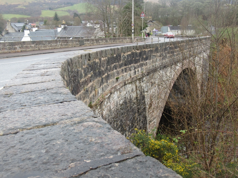
Thomas Telford, 1808-11, widened Mears and Carus-Wilson, 1933.
Single span rubble bridge; tooled rubble segmental arch ring,
string course and cope to parapet. Splayed approach at N.
Bridge badly damaged in floods of 1818 and extensively repaired
by Telford's principal inspector, Joseph Mitchell.
External links are from the relevant listing authority and, where applicable, Wikidata. Wikidata IDs may be related buildings as well as this specific building. If you want to add or update a link, you will need to do so by editing the Wikidata entry.


Other nearby listed buildings