Latitude: 57.3368 / 57°20'12"N
Longitude: -4.4797 / 4°28'46"W
OS Eastings: 250839
OS Northings: 830082
OS Grid: NH508300
Mapcode National: GBR H99B.BRX
Mapcode Global: WH3FT.5V2F
Plus Code: 9C9Q8GPC+P4
Entry Name: Greenlea, Drumnadrochit
Listing Name: Drumnadrochit, Greenlea
Listing Date: 17 April 1986
Category: B
Source: Historic Scotland
Source ID: 348513
Historic Scotland Designation Reference: LB15010
Building Class: Cultural
Also known as: Drumnadrochit, Greenlea
ID on this website: 200348513
Location: Urquhart and Glenmoriston
County: Highland
Electoral Ward: Aird and Loch Ness
Parish: Urquhart And Glenmoriston
Traditional County: Inverness-shire
Tagged with: House
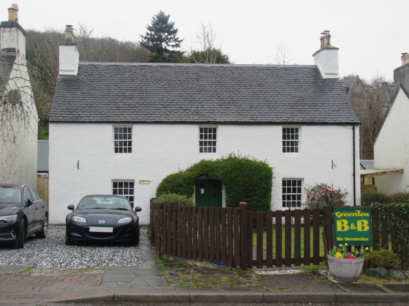
Early 19th century, 2-storey, 3-bay house. All harled.
Symmetrical front with centre door. Slightly smaller 1st floor
windows; 16-pane glazing; coped end stacks with "thack stanes";
slate roof.
Appears as "The Green" on OS.
One of row of houses surrounding former cattle market green.
External links are from the relevant listing authority and, where applicable, Wikidata. Wikidata IDs may be related buildings as well as this specific building. If you want to add or update a link, you will need to do so by editing the Wikidata entry.


Other nearby listed buildings