Approximate Location Map
Large Map »
Latitude: 55.5665 / 55°33'59"N
Longitude: -2.4742 / 2°28'26"W
OS Eastings: 370194
OS Northings: 630411
OS Grid: NT701304
Mapcode National: GBR C452.4D
Mapcode Global: WH8Y4.YCZ0
Plus Code: 9C7VHG8G+H8
Entry Name: Roxburgh Railway Viaduct
Listing Name: Railway Viaduct, Roxburgh
Listing Date: 16 March 1971
Category: A
Source: Historic Scotland
Source ID: 348622
Historic Scotland Designation Reference: LB15097
Building Class: Cultural
Also known as: Railway Viaduct And Footbridge, Roxburgh
ID on this website: 200348622
Location: Roxburgh
County: Scottish Borders
Electoral Ward: Jedburgh and District
Parish: Roxburgh
Traditional County: Roxburghshire
Tagged with: Railway viaduct
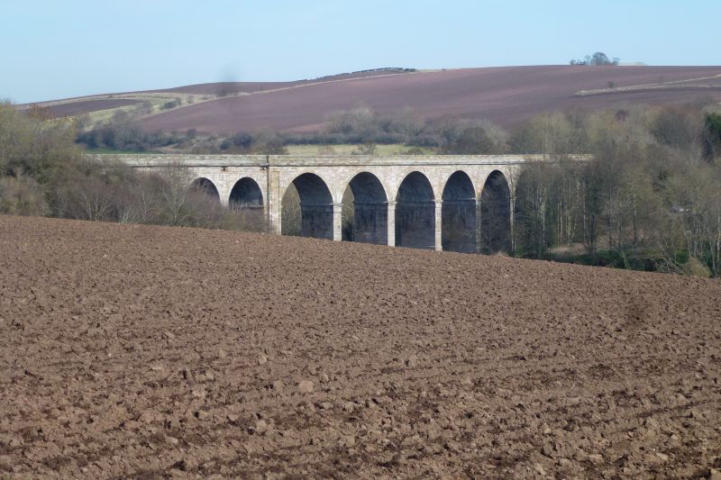
Impressive viaduct across the Teviot, consisting of 6
principal arches, with 4 smaller approach arches on either
side; designed on a curve.
External links are from the relevant listing authority and, where applicable, Wikidata. Wikidata IDs may be related buildings as well as this specific building. If you want to add or update a link, you will need to do so by editing the Wikidata entry.


Other nearby listed buildings
