Approximate Location Map
Large Map »
Latitude: 56.1047 / 56°6'17"N
Longitude: -3.8841 / 3°53'2"W
OS Eastings: 282916
OS Northings: 691819
OS Grid: NS829918
Mapcode National: GBR 1F.M9F3
Mapcode Global: WH4P7.9TPD
Plus Code: 9C8R4438+V9
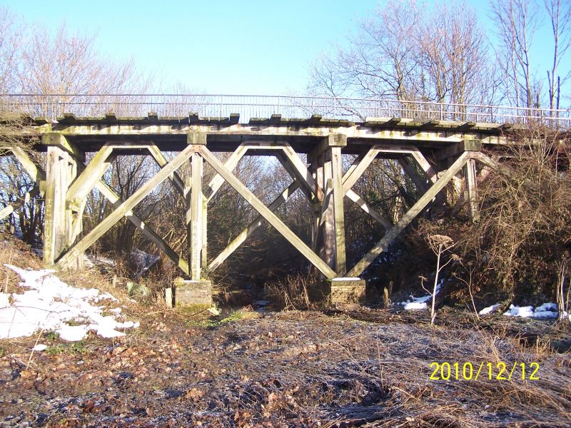
Entry Name: Railway Bridge, Fallin
Listing Name: Fallin Wooden Railway Bridge
Listing Date: 19 December 1988
Category: B
Source: Historic Scotland
Source ID: 348866
Historic Scotland Designation Reference: LB15308
Building Class: Cultural
ID on this website: 200348866
Location: St Ninians
County: Stirling
Electoral Ward: Bannockburn
Parish: St Ninians
Traditional County: Stirlingshire
Tagged with: Railway bridge
Later 19th century wooden trestle bridge. 6 braced and bolted
wooden trestles supported on brick and concrete piers
spanning a burn to the W of Fallin. Trestles support single
line track (disused) from Fallin to junction with
Stirling-Falkirk line, NE of Bannockburn.
This type of viaduct construction was used in boggy
conditions and is now rare.
External links are from the relevant listing authority and, where applicable, Wikidata. Wikidata IDs may be related buildings as well as this specific building. If you want to add or update a link, you will need to do so by editing the Wikidata entry.


Other nearby listed buildings
