Approximate Location Map
Large Map »
Latitude: 57.1035 / 57°6'12"N
Longitude: -2.2902 / 2°17'24"W
OS Eastings: 382519
OS Northings: 801431
OS Grid: NJ825014
Mapcode National: GBR XF.0JBJ
Mapcode Global: WH8PP.SQM7
Plus Code: 9C9V4P35+CW
Entry Name: Waulkmill Bridge, Peterculter
Listing Name: Waulkmill Bridge over Culter Burn.
Listing Date: 16 April 1981
Category: B
Source: Historic Scotland
Source ID: 349405
Historic Scotland Designation Reference: LB15720
Building Class: Cultural
Also known as: Peterculter, Waulkmill Bridge
ID on this website: 200349405
Location: Peterculter
County: Aberdeen
Electoral Ward: Lower Deeside
Parish: Peterculter
Traditional County: Aberdeenshire
Tagged with: Bridge Road bridge
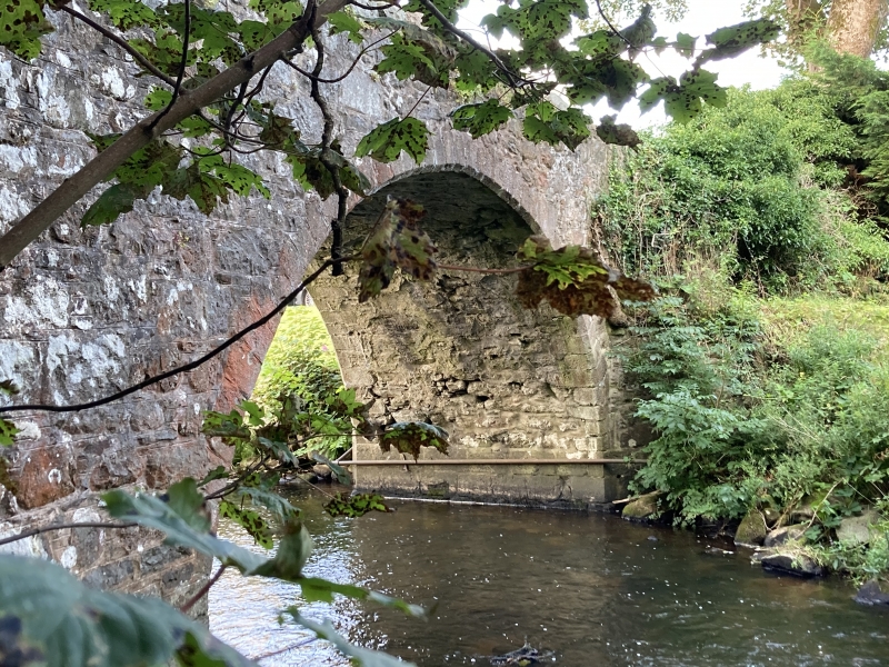
18th century. Single semi-circular arch, humped, Rubble built
with finely worked chamfered voussoirs, square chamfered
recess for panel (missing) at S.W.
External links are from the relevant listing authority and, where applicable, Wikidata. Wikidata IDs may be related buildings as well as this specific building. If you want to add or update a link, you will need to do so by editing the Wikidata entry.


Other nearby listed buildings
