Latitude: 57.2269 / 57°13'37"N
Longitude: -2.524 / 2°31'26"W
OS Eastings: 368459
OS Northings: 815256
OS Grid: NJ684152
Mapcode National: GBR X1.FJJH
Mapcode Global: WH8P0.6MB3
Plus Code: 9C9V6FGG+Q9
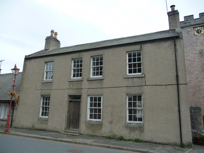
Entry Name: 8 The Square, Monymusk
Listing Name: 8 Monymusk Square
Listing Date: 24 November 1972
Category: C
Source: Historic Scotland
Source ID: 349698
Historic Scotland Designation Reference: LB15996
Building Class: Cultural
ID on this website: 200349698
Location: Monymusk
County: Aberdeenshire
Electoral Ward: Huntly, Strathbogie and Howe of Alford
Parish: Monymusk
Traditional County: Aberdeenshire
Tagged with: House
Probably John Smith, c.1826 in present form. Identical
to No. 7.
Re-categorised as C(S) from B for Group (2006). The listing relates specifically to the group interest of the subject. It applies, as always, to interior as well as exterior, as appropriate to building type.
External links are from the relevant listing authority and, where applicable, Wikidata. Wikidata IDs may be related buildings as well as this specific building. If you want to add or update a link, you will need to do so by editing the Wikidata entry.


Other nearby listed buildings