Approximate Location Map
Large Map »
Latitude: 57.3499 / 57°20'59"N
Longitude: -1.9348 / 1°56'5"W
OS Eastings: 404022
OS Northings: 828823
OS Grid: NK040288
Mapcode National: GBR P9L9.697
Mapcode Global: WH9PV.7JXC
Plus Code: 9C9W83X8+X3
Entry Name: Slains House, Kirkton Of Slains, Collieston
Listing Name: Manse of Slains
Listing Date: 11 September 1984
Category: C
Source: Historic Scotland
Source ID: 349758
Historic Scotland Designation Reference: LB16050
Building Class: Cultural
ID on this website: 200349758
Location: Slains
County: Aberdeenshire
Electoral Ward: Ellon and District
Parish: Slains
Traditional County: Aberdeenshire
Tagged with: Manse
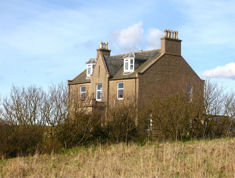
William Smith 1876. 2-storey and attic harled with margins,
3-window front with centre slightly advanced with gable and
porch having Tudor arched doorpiece and ball finials. Ground
floor windows tripartite. Staircase gable to back. N.W.
office wing.
External links are from the relevant listing authority and, where applicable, Wikidata. Wikidata IDs may be related buildings as well as this specific building. If you want to add or update a link, you will need to do so by editing the Wikidata entry.


Other nearby listed buildings
