Approximate Location Map
Large Map »
Latitude: 57.3624 / 57°21'44"N
Longitude: -1.9212 / 1°55'16"W
OS Eastings: 404836
OS Northings: 830214
OS Grid: NK048302
Mapcode National: GBR P9M8.6GM
Mapcode Global: WH9PV.G6BR
Plus Code: 9C9W936H+XG
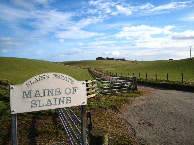
Entry Name: Mains Of Slains
Listing Name: Mains of Slains Farmhouse
Listing Date: 16 April 1971
Category: B
Source: Historic Scotland
Source ID: 349760
Historic Scotland Designation Reference: LB16052
Building Class: Cultural
ID on this website: 200349760
Location: Slains
County: Aberdeenshire
Electoral Ward: Ellon and District
Parish: Slains
Traditional County: Aberdeenshire
Tagged with: Human settlement Farmstead
Late 18th century. 2-storey 3-window harled with coped
chimneys and moulded skewputts. Later single-storey and
attic back wing. Modern glass porch, glazing altered.
External links are from the relevant listing authority and, where applicable, Wikidata. Wikidata IDs may be related buildings as well as this specific building. If you want to add or update a link, you will need to do so by editing the Wikidata entry.


Other nearby listed buildings
