Approximate Location Map
Large Map »
Latitude: 56.1157 / 56°6'56"N
Longitude: -3.5724 / 3°34'20"W
OS Eastings: 302325
OS Northings: 692550
OS Grid: NT023925
Mapcode National: GBR 1T.LMDN
Mapcode Global: WH5QJ.3K40
Plus Code: 9C8R4C8H+72
Entry Name: Bridge, Saline Burn, Bridge Street, Saline
Listing Name: Saline Bridge over Saline Burn, Saline
Listing Date: 20 June 1972
Category: C
Source: Historic Scotland
Source ID: 350869
Historic Scotland Designation Reference: LB17023
Building Class: Cultural
ID on this website: 200350869
Location: Saline
County: Fife
Electoral Ward: West Fife and Coastal Villages
Parish: Saline
Traditional County: Fife
Tagged with: Road bridge
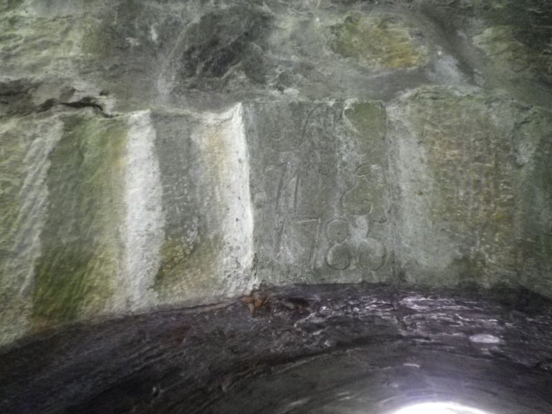
Small single semi-circular arch, rubble, dressed voussoirs,
N keystone inscribed ST/WE/1785.
Re-categorised as C(S) from B for Group (2006). The listing relates specifically to the group interest of the subject. It applies, as always, to interior as well as exterior, as appropriate to building type.
External links are from the relevant listing authority and, where applicable, Wikidata. Wikidata IDs may be related buildings as well as this specific building. If you want to add or update a link, you will need to do so by editing the Wikidata entry.


Other nearby listed buildings
