Approximate Location Map
Large Map »
Latitude: 55.2455 / 55°14'43"N
Longitude: -3.8135 / 3°48'48"W
OS Eastings: 284805
OS Northings: 596084
OS Grid: NX848960
Mapcode National: GBR 17TS.6G
Mapcode Global: WH5VN.DF93
Plus Code: 9C7R65WP+5J
Entry Name: Eccles
Listing Name: Eccles House
Listing Date: 26 June 1986
Category: B
Source: Historic Scotland
Source ID: 351194
Historic Scotland Designation Reference: LB17301
Building Class: Cultural
ID on this website: 200351194
Location: Penpont
County: Dumfries and Galloway
Electoral Ward: Mid and Upper Nithsdale
Parish: Penpont
Traditional County: Dumfriesshire
Tagged with: Building
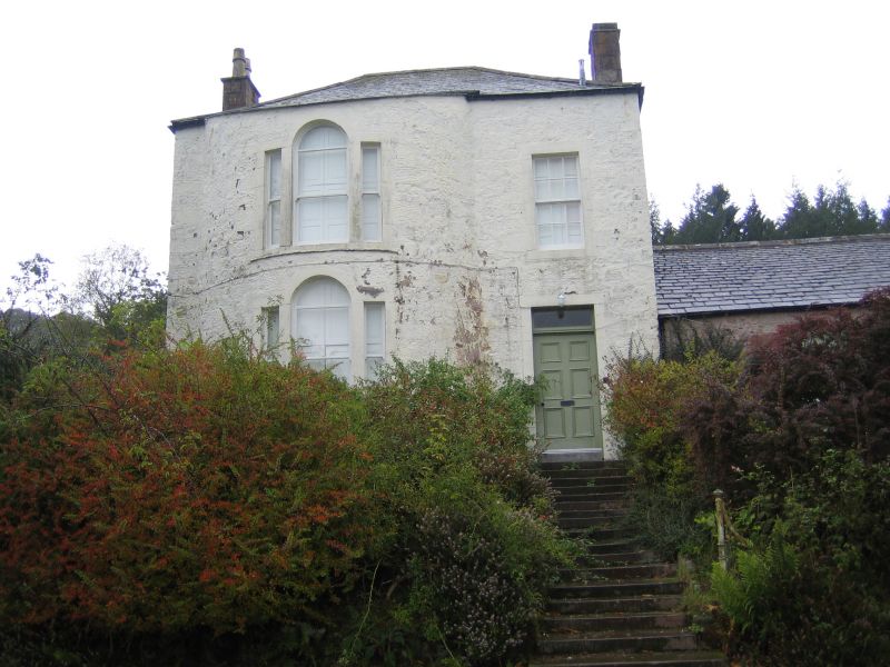
Composite house, originally built around a courtyard (north
stabling range largely demolished 1965). Restored probably
circa 1830, south block perhaps also built then; remainder
mostly 2nd half 18th century with alterations. Now an L-plan
country house, 2 single storey ranges linking taller 2-storey
square blocks at angle and at terminals. Renovated 1965,
Gordon J Kinghorn of Dumfries, architect. Rubble-built with
ashlar dressings, all whitewashed. North and east blocks have
single bay elevations and pyramidal roofs (former block now a
garage); (larger) south block (widened to rear (north east)
later in century) has 2-bay south east elevation with
Venetian windows in full-height wide bowed bay, panelled door
to right, with fanlight; piended roof.
Windows mostly small-paned sashes.
Stacks coped or corniced; mostly wall-head stacks, massive
ridge stack in low north east range, above former kitchen.
Slate roofs throughout (mostly graded slates).
Interior: massively-thick wall at ground level between
entrance hall and sitting room (to north east) possibly a
fragment of earlier tower house; stair in south block rebuilt
in later addition.
Building possibly began with a tower house, to which wings
were added in stages, possibly completing a courtyard plan.
Kinghorn leaflet cites 1776 map where Eccles house is shown
as being ruinous.
Sheppard's MODERN ATHENS (1829) also notices "the ruin of
Eccles" (in the entry relating to Barjarg); the rebuilding
of the south block (which might occupy the site of an earlier
tower house) may therefore date from shortly after 1829.
1765 map of Eccles estate by J Wells
(S.R.O. RHP 810) is difficult to interpret, but on it Eccles
house appears to comprise a rectangular block facing south
east, with a parallel range to rear.
1801 plan (S.R.O. RHP 37840) show 3 ranges about an open
court much as actually existed until 1965; on a small copy of
sketch held in NMRS
(Drumlanrig Inv. 35) (on paper dated 1811)
Eccles house appears to be built around an open quadrangle
(original - presumably larger scale - sketch not consulted).
External links are from the relevant listing authority and, where applicable, Wikidata. Wikidata IDs may be related buildings as well as this specific building. If you want to add or update a link, you will need to do so by editing the Wikidata entry.


Other nearby listed buildings
