Approximate Location Map
Large Map »
Latitude: 56.6524 / 56°39'8"N
Longitude: -2.8131 / 2°48'47"W
OS Eastings: 350246
OS Northings: 751475
OS Grid: NO502514
Mapcode National: GBR VN.YYC7
Mapcode Global: WH7QM.R2N0
Plus Code: 9C8VM52P+XQ
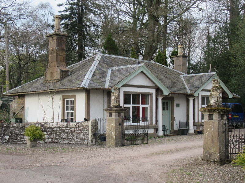
Entry Name: West Lodge, Reswallie
Listing Name: Reswallie - West Lodge
Listing Date: 11 June 1971
Category: B
Source: Historic Scotland
Source ID: 351648
Historic Scotland Designation Reference: LB17684
Building Class: Cultural
Also known as: Reswallie, West Lodge
ID on this website: 200351648
Location: Rescobie
County: Angus
Electoral Ward: Forfar and District
Parish: Rescobie
Traditional County: Angus
Tagged with: Gatehouse
Single-storey harl and slate with R. doric columned porch
flanked by projecting bays. Late 19th century.
External links are from the relevant listing authority and, where applicable, Wikidata. Wikidata IDs may be related buildings as well as this specific building. If you want to add or update a link, you will need to do so by editing the Wikidata entry.


Other nearby listed buildings
