Approximate Location Map
Large Map »
Latitude: 56.6529 / 56°39'10"N
Longitude: -2.8108 / 2°48'38"W
OS Eastings: 350383
OS Northings: 751526
OS Grid: NO503515
Mapcode National: GBR VN.YYY3
Mapcode Global: WH7QM.S1PN
Plus Code: 9C8VM53Q+5M
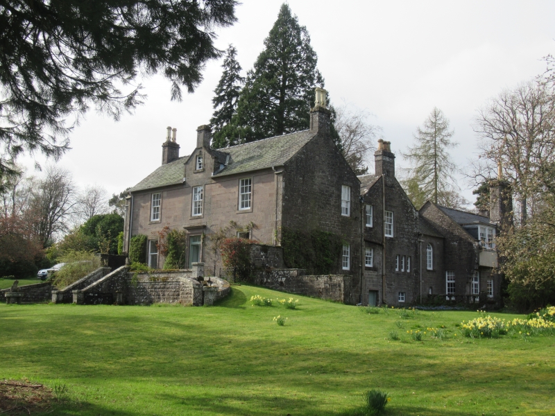
Entry Name: Reswallie House
Listing Name: Reswallie House
Listing Date: 11 June 1971
Category: B
Source: Historic Scotland
Source ID: 354230
Historic Scotland Designation Reference: LB19815
Building Class: Cultural
ID on this website: 200354230
Location: Rescobie
County: Angus
Electoral Ward: Forfar and District
Parish: Rescobie
Traditional County: Angus
Tagged with: House
Small two-storey classic mansion house, ashlar and slate
with centre wall-head gablet dated 1794. Late 19th century
additions and terracing.
External links are from the relevant listing authority and, where applicable, Wikidata. Wikidata IDs may be related buildings as well as this specific building. If you want to add or update a link, you will need to do so by editing the Wikidata entry.


Other nearby listed buildings
