Approximate Location Map
Large Map »
Latitude: 58.9937 / 58°59'37"N
Longitude: -3.2011 / 3°12'3"W
OS Eastings: 331080
OS Northings: 1012458
OS Grid: HY310124
Mapcode National: GBR L4GY.VQG
Mapcode Global: WH69W.S6VQ
Plus Code: 9CCRXQVX+FH
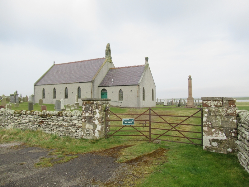
Entry Name: Stenness Church
Listing Name: Stenness Kirk
Listing Date: 9 December 1977
Category: C
Source: Historic Scotland
Source ID: 352683
Historic Scotland Designation Reference: LB18602
Building Class: Cultural
ID on this website: 200352683
Location: Stenness
County: Orkney Islands
Electoral Ward: West Mainland
Parish: Stenness
Traditional County: Orkney
Tagged with: Cemetery Church building Church with cemetery
c. 1910. Oblong. Pebble-dashed. Slated roof. Gabled ends;
with belfry. Pointed windows. Vestry.
In ecclesiastical use. On site of ancient church which
had semi-circular tower.
External links are from the relevant listing authority and, where applicable, Wikidata. Wikidata IDs may be related buildings as well as this specific building. If you want to add or update a link, you will need to do so by editing the Wikidata entry.


Other nearby listed buildings
