Approximate Location Map
Large Map »
Latitude: 58.9947 / 58°59'40"N
Longitude: -3.1863 / 3°11'10"W
OS Eastings: 331931
OS Northings: 1012553
OS Grid: HY319125
Mapcode National: GBR L4HY.WMF
Mapcode Global: WH69X.05ZY
Plus Code: 9CCRXRV7+VF
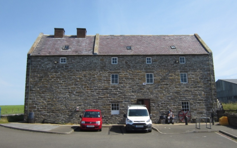
Entry Name: Tormiston Mill
Listing Name: Mill of Tormiston
Listing Date: 8 December 1971
Category: B
Source: Historic Scotland
Source ID: 352684
Historic Scotland Designation Reference: LB18603
Building Class: Cultural
ID on this website: 200352684
Location: Stenness
County: Orkney Islands
Electoral Ward: West Mainland
Parish: Stenness
Traditional County: Orkney
Tagged with: Watermill
1884-1885, 2 1/2 storeys. Random rubble; harl-pointed.
Slated roof; two vents over kiln. Machinery water-wheel
and Lade in good order.
Disused since 1965.
External links are from the relevant listing authority and, where applicable, Wikidata. Wikidata IDs may be related buildings as well as this specific building. If you want to add or update a link, you will need to do so by editing the Wikidata entry.


Other nearby listed buildings
