Approximate Location Map
Large Map »
Latitude: 56.5623 / 56°33'44"N
Longitude: -2.5835 / 2°35'0"W
OS Eastings: 364236
OS Northings: 741299
OS Grid: NO642412
Mapcode National: GBR VV.NHZL
Mapcode Global: WH8S8.9B03
Plus Code: 9C8VHC68+WJ
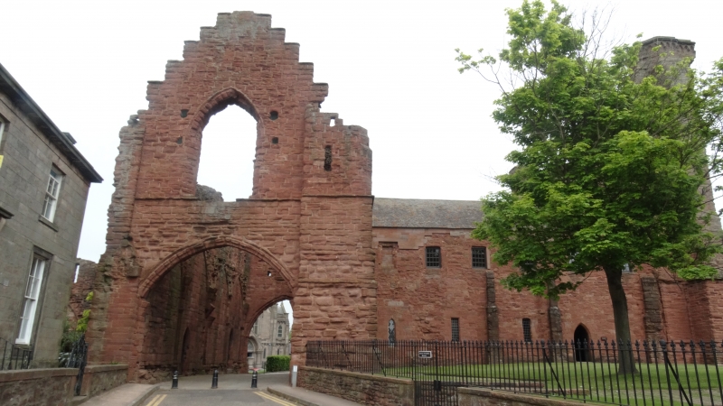
Entry Name: Arbroath Abbey - Pend
Listing Date: 11 October 1971
Category: A
Source: Historic Scotland
Source ID: 356384
Historic Scotland Designation Reference: LB21132
Building Class: Cultural
ID on this website: 200356384
Location: Arbroath
County: Angus
Town: Arbroath
Electoral Ward: Arbroath East and Lunan
Traditional County: Angus
Tagged with: Architectural structure
Fortified gatehouse, with remains of groined roof. Corbel
course at upper floor level over archway: formerly defended
by portcullis. 15th century.
Under Guardianship of Ministry of Works.
External links are from the relevant listing authority and, where applicable, Wikidata. Wikidata IDs may be related buildings as well as this specific building. If you want to add or update a link, you will need to do so by editing the Wikidata entry.


Other nearby listed buildings
