Approximate Location Map
Large Map »
Latitude: 56.5616 / 56°33'41"N
Longitude: -2.5834 / 2°35'0"W
OS Eastings: 364244
OS Northings: 741226
OS Grid: NO642412
Mapcode National: GBR VV.NQ04
Mapcode Global: WH8S8.9B2M
Plus Code: 9C8VHC68+MM
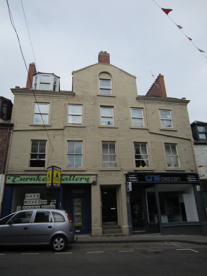
Entry Name: 267-269 High Street, Arbroath
Listing Name: Nos. 267, 269 and 271 High Street
Listing Date: 15 January 1980
Category: C
Source: Historic Scotland
Source ID: 356392
Historic Scotland Designation Reference: LB21138
Building Class: Cultural
ID on this website: 200356392
Location: Arbroath
County: Angus
Town: Arbroath
Electoral Ward: Arbroath East and Lunan
Traditional County: Angus
Tagged with: Architectural structure
Three-storey domestic, ashlar and slate, with centre wall-head
gable and eaves cornice. Late 18th cent. Modern ground floor
shops.
External links are from the relevant listing authority and, where applicable, Wikidata. Wikidata IDs may be related buildings as well as this specific building. If you want to add or update a link, you will need to do so by editing the Wikidata entry.


Other nearby listed buildings
