Approximate Location Map
Large Map »
Latitude: 56.2929 / 56°17'34"N
Longitude: -3.2328 / 3°13'58"W
OS Eastings: 323791
OS Northings: 711845
OS Grid: NO237118
Mapcode National: GBR 26.7KNC
Mapcode Global: WH6R1.93S3
Plus Code: 9C8R7QV8+5V
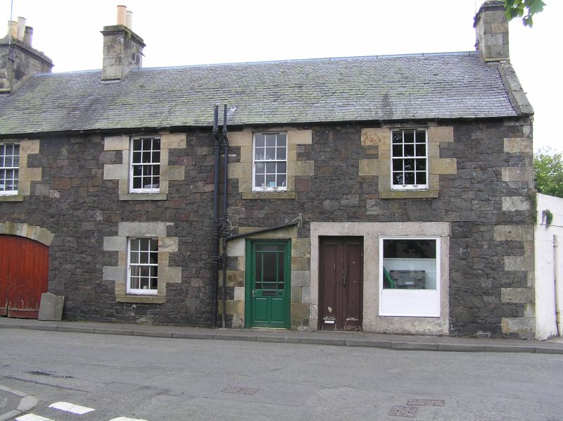
Entry Name: 12 Kilnheugh, Auchtermuchty
Listing Name: Houses and Shop (Miller and Harrower) Kilnheugh
Listing Date: 18 August 1972
Category: C
Source: Historic Scotland
Source ID: 356727
Historic Scotland Designation Reference: LB21447
Building Class: Cultural
ID on this website: 200356727
Location: Auchtermuchty
County: Fife
Town: Auchtermuchty
Electoral Ward: Howe of Fife and Tay Coast
Traditional County: Fife
Tagged with: Architectural structure
Late 18th/early 19th century 2-storey.
Originally 3-window south section only, extended to 7
with central segmentally arched pend; earlier part whin
rubble, later part snecked, freestone dressings and chimneys,
slated roof.
Re-categorised as C(S) from B for Group (2006). The listing relates specifically to the group interest of the subject. It applies, as always, to interior as well as exterior, as appropriate to building type.
External links are from the relevant listing authority and, where applicable, Wikidata. Wikidata IDs may be related buildings as well as this specific building. If you want to add or update a link, you will need to do so by editing the Wikidata entry.


Other nearby listed buildings
