Latitude: 55.45 / 55°27'0"N
Longitude: -4.6284 / 4°37'42"W
OS Eastings: 233864
OS Northings: 620491
OS Grid: NS338204
Mapcode National: GBR 39.YQX4
Mapcode Global: WH2PW.W85S
Plus Code: 9C7QF92C+2J
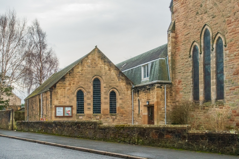
Entry Name: Hall, St Leonard's Parish Church, St Leonard's Road, Ayr
Listing Name: St Leonard's Road, St Leonard's Parish Church (Church of Scotland) and Hall Including Lamp Standards, Postbox and Boundary Wall
Listing Date: 10 January 1980
Category: B
Source: Historic Scotland
Source ID: 357193
Historic Scotland Designation Reference: LB21767
Building Class: Cultural
Also known as: Ayr, St Leonard's Road, St Leonard's Parish Church, Hall
ID on this website: 200357193
Location: Ayr
County: South Ayrshire
Electoral Ward: Ayr West
Traditional County: Ayrshire
Tagged with: Hall
External links are from the relevant listing authority and, where applicable, Wikidata. Wikidata IDs may be related buildings as well as this specific building. If you want to add or update a link, you will need to do so by editing the Wikidata entry.


Other nearby listed buildings