Approximate Location Map
Large Map »
Latitude: 56.0554 / 56°3'19"N
Longitude: -3.2376 / 3°14'15"W
OS Eastings: 323020
OS Northings: 685414
OS Grid: NT230854
Mapcode National: GBR 26.QJL4
Mapcode Global: WH6S6.72J6
Plus Code: 9C8R3Q46+4X
Entry Name: Burntisland Harbour
Listing Name: Burntisland Harbour
Listing Date: 31 March 1995
Category: B
Source: Historic Scotland
Source ID: 358374
Historic Scotland Designation Reference: LB22753
Building Class: Cultural
ID on this website: 200358374
Location: Burntisland
County: Fife
Town: Burntisland
Electoral Ward: Burntisland, Kinghorn and Western Kirkcaldy
Traditional County: Fife
Tagged with: Harbour
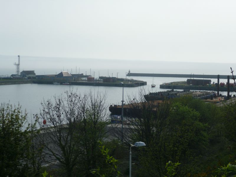
Re-modelling of 1540s harbour, Meik & Bouch 1876 - 1902. 2 wet docks and tidal basin entrance 38' wide and 16' - 22' deep.
TIDAL HARBOURS: rectangular Outer Harbour splayed to E and narrowing to adjoining round-ended Inner Harbour to N.
WET DOCKS: rectangular wet docks, East Dock narrowing to E with jetties to S and capstans flanking mouth: West Dock also rectangular with entrance to S.
Coped coursed rubble breakwater to SW. Coped ashlar passenger slipway with stone sets and pulvinated band course, and wooden-jib post crane on projecting arm to SW between Inner and Outer Harbours. W breakwater light, fixed, small cast-iron? pier with lantern in caphouse behind cast-iron balcony.
Originally known as Portus Gratiae, Burntisland Harbour was formerly tidal, constantly being improved, with Sir John Gladstone of Fasque funding a low water pier, the Prince Albert Pier of 1844 and the construction of a wet dock (the West Dock) of 5.5 acres opened 1.12.1876 for the export of coal and the East Dock opened in 1900. The chief trade of coal and cattle was enhanced by the opening of the Granton ferry.
In 1795, W Sibbald, Engineer and surveyor, headed a Commission on Burntisland Harbour reporting on the disrepair and suggesting certain improvements; this was followed by reports from Sir John Rennie in 1809 and Sir Thomas Telford in 1828. In 1837 Burntisland was recognised as the ideal 'principal ferry station on the north side of the Forth'. The Northern terminal for the first train ferry service in the world, operated by the Edinburgh, Perth and Dundee Railway Company (later the North British) began operation in 1849 with Sir Thomas Bouch's newly designed loading-ships which lifted wagons by means of a wheeled crane which was lowered and raised depending upon the tide. Five 2-funnelled paddleships carried the wagons while 4 passenger steamers ferried the people.
External links are from the relevant listing authority and, where applicable, Wikidata. Wikidata IDs may be related buildings as well as this specific building. If you want to add or update a link, you will need to do so by editing the Wikidata entry.


Other nearby listed buildings
